Elevation 5,722 m | Mountain range Andes | |
 | ||
Similar Escalante, Cerro Colorado, Sairecabur, Putana Volcano, Tocorpuri | ||
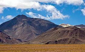
Curiquinca is a stratovolcano that straddles the border between Bolivia and Chile. It lies immediately E of Cerro Colorado and NE to volcán Escalante (El Apagado), all of which are considered to be part of the Sairecabur volcanic group. The light area behind the mountain is part of a large sulfur deposit, location of the - now abandoned - sulfur mines "Azufrera El Apagado" on the Chilean side and its counterpart "Azufrera Rosita" on the Bolivian side of the border.
Map of Curiquinca, Bolivia
References
Curiquinca Wikipedia(Text) CC BY-SA
