
Location Bolivia-Chile Last eruption Unknown Mountain range Andes | Mountain type Stratovolcano Elevation 5,808 m Parent range Andes | |
 | ||
Similar Putana Volcano, Irruputuncu, Cerro del León, Cerro del Azufre, Caichinque | ||
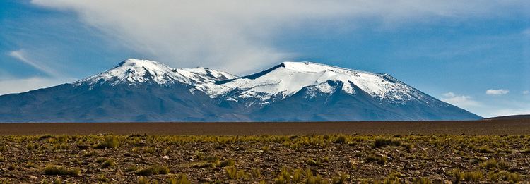
Cerros de Tocorpuri is a volcanic complex located along the border between Bolivia and Chile. Cerros de Tocorpuri's summit crater has a diameter of 1.4 km. On its west side lies a rhyolite lava dome called Cerro La Torta (Cake Hill), named so because of its cylindrical cake shape. Cerro La Torta has a volume of about 5 cu km and the height of this lava dome above the surrounding terrain is about 450 m. Its steep sides are covered with scree and its top surface is ridged.
Map of Tocorpuri
The complex is located at about 30 km. from the El Tatio geothermal energy field.
References
Tocorpuri Wikipedia(Text) CC BY-SA