
- location Earlwood | ||
 | ||
Similar Duck Creek, Vineyard Creek, Orphan School Creek, Devlins Creek, Terrys Creek | ||
Cup and Saucer Creek, an urban watercourse of the Cooks River catchment, is located in the Canterbury-Bankstown region of Sydney, in New South Wales, Australia.
Contents
Map of Cup And Saucer Creek, New South Wales, Australia
Course and featuresEdit
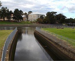
Cup and Saucer Creek rises in Canterbury local government area, near Wiley Park railway station and flows in an east north-easterly direction through the suburbs of Roselands, Kingsgrove, and Clemton Park, where it makes its confluence with the Cooks River, within the suburb of Earlwood. The upper reaches of the creek are a piped drainage system, which becomes part drain and part creek in the lower reaches. The Cup and Saucer Creek Catchment Management Study by the Water Board in 1992 showed extensive toxic organics in the form of polycyclic aromatic hydrocarbons and organochlorines.
The creek is so named because of sandstone formations in the former bed of the creek.
A concrete culvert over Bexley Road constructed in 1920 is listed on the NSW State Heritage Register.