
Airport type Public 14/32 2,800 Elevation 65 m | Owner City of Cuero Elevation AMSL 214 ft / 65 m 2,800 853 | |
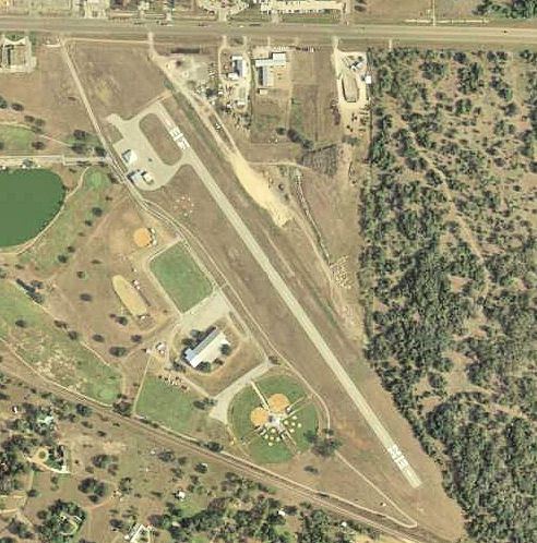 | ||
Address Industrial Blvd, Cuero, TX 77954, USA Similar Cuero City Hall, Cuero Municipal Park, Cuero Community Hospital, Victoria Advocate Cuero Bu, Dewitt Sheriff's Office | ||
Cuero Municipal Airport (FAA LID: T71) is a public airport located approximately 1 mile (1.6 km) east-southeast of Cuero, Texas. It provides general aviation service.
Contents
History
Opened on 1 April 1941 with 5000ft all-way turf runway (same location as present day Dewitt County Prison, hangars still used). Began training United States Army Air Corps flying cadets under contract to Brayton Flying Service, Inc. Assigned to United States Army Air Forces Gulf Coast Training Center (later Central Flying Training Command) as a primary (level 1) pilot training airfield. had four local axillary airfields for emergency and overflow landings. Flight training was performed with Fairchild PT-19s as the primary trainer. Also had several PT-17 Stearmans and a few old Curtiss P-1 Hawks and Airco DH.4s assigned.
Deactivated on 4 August 1944 with the drawdown of AAFTC's pilot training program. Declared surplus and turned over to the Army Corps of Engineers on 30 September 1945. Eventually discharged to the War Assets Administration (WAA) and became a civil airport.
Present
As of February 2015, there are 2 hangars and 4 tie downs for general aviation aircraft.