
Isolation 0.91 mi (1.46 km) Elevation 4,222 m | Easiest route Class 2 Prominence 187 m | |
 | ||
Topo map USGS 7.5' topographic mapBreckenridge, Colorado Similar Pacific Peak, Fletcher Mountain, Bald Mountain, Peak 10, Clinton Peak | ||
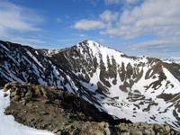
Crystal Peak is a high mountain summit in the Tenmile Range of the Rocky Mountains of North America. The 13,859-foot (4,224 m) thirteener is located in Arapaho National Forest, 5.9 miles (9.5 km) southwest (bearing 220°) of the Town of Breckenridge in Summit County, Colorado, United States.
Contents
Map of Crystal Peak, Colorado 80424, USA
Approach RoutesEdit
Most climbers approach Crystal Peak from the east, in particular via the Crystal Lakes basin. This approach, a pleasant hike, follows jeep trails until treeline and Lower Crystal Lake. Four wheel drive vehicles can generally make it this far. A trail on the north side of the lake takes climbers to Upper Crystal Lake, where gentle scree slopes provide access to the ridges north of the summit.
References
Crystal Peak (Tenmile Range) Wikipedia(Text) CC BY-SA