
Highest elevation 60 m (200 ft) | Elevation 60 m | |
 | ||
Crozier Island (Danish: 'Crozier Ø') is one of three islands located in the Kennedy Channel section of Nares Strait in the high Arctic. It is part of the Qaasuitsup municipality, Greenland.
Contents
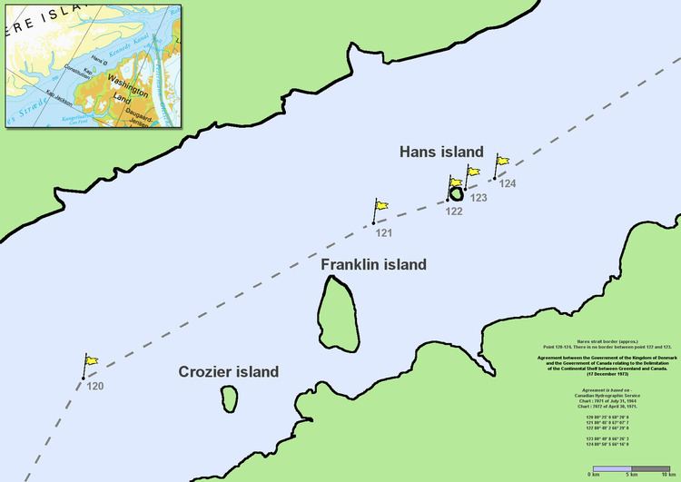
Map of Crozier Island, Greenland
Geography
Located to the SW of Franklin Island off Lafayette Bay, Crozier Island is the southernmost island of the Kennedy Channel group, the other ones being Franklin Island and Hans Island. The former is also part of Greenland, whilst the latter's ownership is disputed between Greenland and Canada. The cliffs at its southwest side rise to a height of 60 m (200 ft) and the island is reported to be easily identified.
Crozier Island is named after the Irish-born, British naval officer Francis Rawdon Moira Crozier, second-in-command (and commander after Franklin's death) of John Franklin's ill-fated Naval Northwest Passage Expedition, 1845–1848, by Elisha Kent Kane between 1854 and 1855 during his second Grinnell Expedition, after it was sighted by Hans Hendrik and the American William Morton in June 1854.