
Status mostly destroyed Date closed 1836 Locks 28 Date of act 1801 | Date of first use 1809 | |
 | ||
Similar South Norwood Lake and, Grosvenor Canal, City Canal, Shropshire Canal, Garthorne Road Nature R | ||
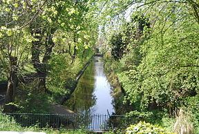
Croydon canal betts park penge se london
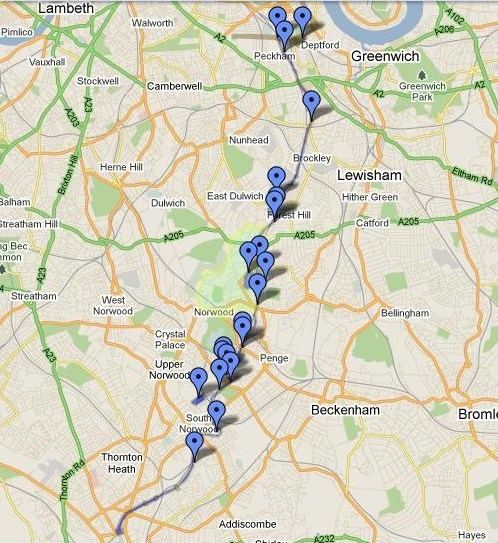
The Croydon Canal ran 9.25 miles (15 km) from Croydon, via Forest Hill, to the Grand Surrey Canal at New Cross in south London, England. It opened in 1809 and closed in 1836, the first canal to be abandoned by an Act of Parliament.
Contents
- Croydon canal betts park penge se london
- A walk along the croydon canal towpath pt 1
- History
- Today
- References
A walk along the croydon canal towpath pt 1
History
Authorised by an Act of Parliament in 1801, the canal was originally intended to extend northwards to Rotherhithe, but the simultaneous construction of the Grand Surrey Canal provided a convenient access route. It was 9.25 miles (15 km) long, and opened on 22 October 1809.
The Croydon Canal linked to the Croydon, Merstham and Godstone Railway (itself connected to the Surrey Iron Railway), enabling the canal to be used to transport stone and lime from workings at Merstham. The canal was never extended further south-west, as was initially intended, to reach Epsom.
The canal was originally planned with two inclined planes but 28 locks, arranged in two flights, were used instead. To keep the canal supplied with water, reservoirs were constructed at Sydenham and South Norwood; the latter still exists as South Norwood Lake in a public park.
The canal was 34 feet (10 m) wide. It had a maximum depth of 5 feet (1.5 m). By 1811 22 barges plied the canal. The barges were 60 feet (18 m) long and 9 feet (2.7 m) wide and could carry about 30 tons. The main cargo was timber.
After the initial flights of locks, most of the canal followed the 161 ft (49.1m) contour.
The final two locks at Croydon Common raised the canal to the 174 ft (53m) contour, and because there was no natural source of water a steam pumping station was built at the foot of the locks to pump water up to the summit pound.
The canal was never a success and closed in 1836, the first canal to be abandoned by an Act of Parliament. Much of the alignment was used by the London & Croydon Railway Company, which had bought the canal for £40,250, for part of the railway between London Bridge and West Croydon station, which is on the site of the canal basin.
Today
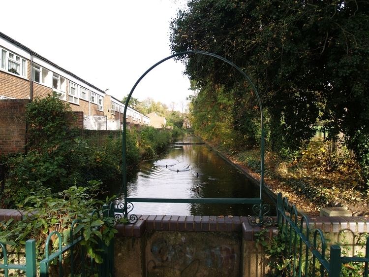
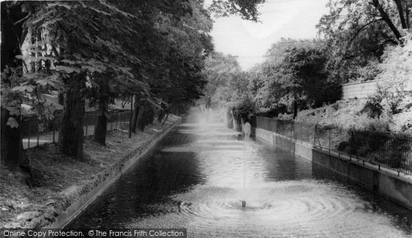
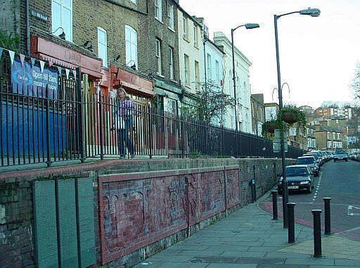
After the canal closed, sections were retained for leisure use, and some remained in water for a considerable time. The section at Betts Park in Anerley was used as a boating lake, and the area was called Anerley Tea Rooms. The canal was turned into a concrete trough in 1934, and can be seen at the northern corner of Betts Park. Another section exists as a long curved pond in the Dacres Wood Nature Reserve in Dacres Road, Forest Hill. This was considered for redevelopment in 1989, but research by Lewisham Council resulted in its identity being confirmed and it now forms an attractive wetland, having been returned to its former width. There is a high pavement in David's Road, Forest Hill, which is thought to be part of the towpath. Part of the wall below the path has been rebuilt with murals depicting transport in Forest Hill. The Norwood reservoir is now preserved as South Norwood Lake.