
Age of rock 29.5 Ma | ||
 | ||
Similar Lava Butte, Powell Butte, Three Sisters | ||
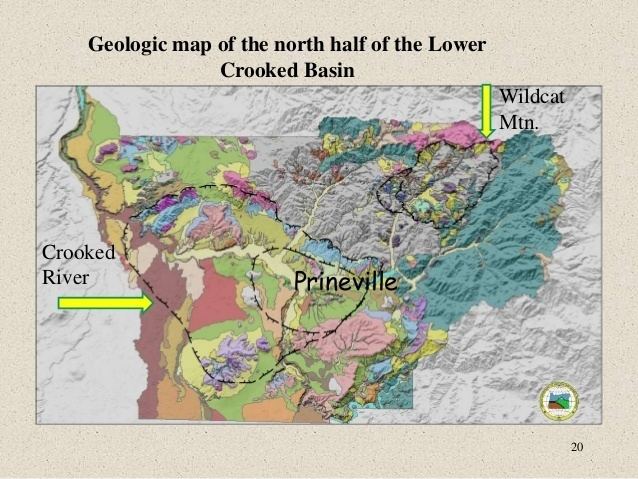
The Crooked River caldera is a large and ancient volcano that straddles three central Oregon counties. The diameter of the caldera is about 41 km x 27 km and is notable for the welded tuff present in such locations as Gray Butte, Smith Rock, Powell Buttes, and Barnes Butte. The volcano is considered extinct and last erupted about 29.5 Ma.
Map of Crooked River caldera, Oregon 97754, USA
References
Crooked River caldera Wikipedia(Text) CC BY-SA