
Population 670 (2006 census) Local time Saturday 1:15 AM | Postcode(s) 7302 Postal code 7302 | |
 | ||
Weather 16°C, Wind NW at 14 km/h, 73% Humidity | ||
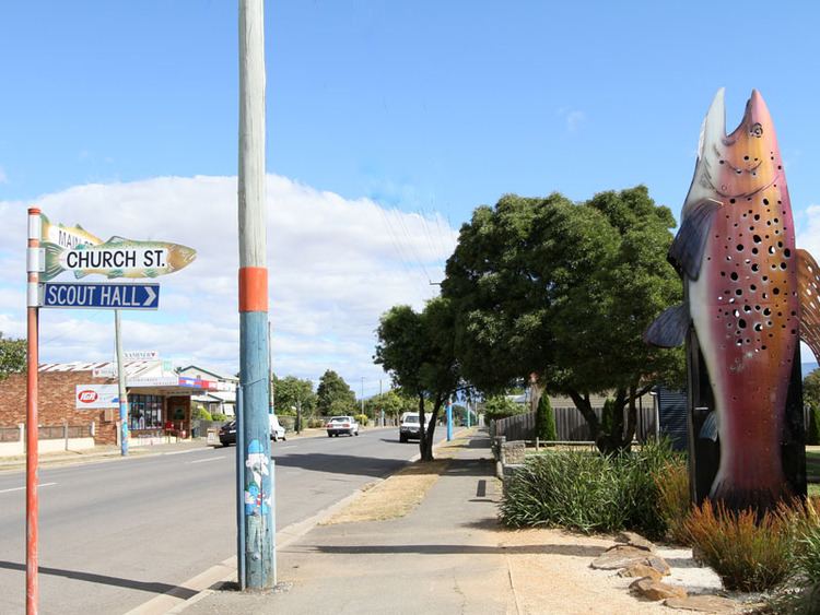
Cressy is a small town 35 kilometres (22 mi) south-west of Launceston, Tasmania. It came into existence in the 1850s to service the surrounding wheat farms. At the 2006 census, Cressy had a population of 670. It is known as Tasmania's "Trout capital" for the good fishing in the area. It is also home to an extensive agriculture research facility for the Tasmanian Institute of Agricultural Research.
Contents
Map of Cressy TAS 7302, Australia
Cressy Post Office opened on 17 September 1856.
Nearby towns include: Bishopsbourne, Bracknell, Liffey, Blackwood Creek, Poatina and Longford.
History
Cressy was established as the main centre for the Cressy Company. The Cressy Company's first director Captain Bartholemew Boyle Thomas chose to name company after the Battle of Crecy in the 14th Century, at which one of his ancestors fought. The Cressy Company also known as the "Cressy Establishment", was a large agricultural company which owned a significant portion of the Norfolk Plains. The first building in Cressy was The Cressy Hotel built in 1845 by William Brumby. Cressy became an official township in 1848. Much of the land in the area was owned by the O'Connor family, founded by Irish migrant Roderic O'Connor.
Brumby's Creek, the Weirs, the Macquarie Lake and the Liffey rivers serve as a popular trout fishing spot. The annual Tasmanian Trout Expo is hosted in Cressy.