
Population 375 (2011 census) LGA(s) Meander Valley Council Mean max temp Mean min temp Local time Saturday 5:24 PM | Postcode(s) 7302 Postal code 7302 | |
 | ||
Weather 24°C, Wind NW at 19 km/h, 37% Humidity | ||
Bracknell is a small rural town in northern Tasmania, Australia that was established to serve the needs of the forestry industry but is now a centre for the local farming community.
Contents
Map of Bracknell TAS 7302, Australia
History
The township of Bracknell was surveyed prior to 1859, at which time an auction of town blocks was held, but only became established in the early 1870s. By 1874 there was a church, two school buildings, a hotel and several other buildings. The town's land had formerly been owned by the Church of England. All the streets in Bracknell have been given female names, a curiosity that dates from when the town was laid out. The current hotel has been in operation since 1880, originally as the Enfield Hotel. The post office opened on 1 August 1872.
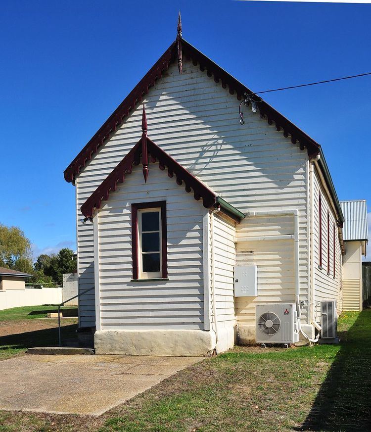
The first Methodist services in the town were held in a barn around November to December 1863. As the congregation grew a church was needed and so the foundation stone for a Primitive Methodist chapel was laid on 14 October 1864. This first church was later removed so the current building could be constructed on its site. A parsonage was added in 1902, the year of the Methodist union that formed the Methodist Church of Australasia. The present church's foundation stone was laid 4 April 1922 and it was opened the same year at a cost of 1250 pounds. The church became part of the Uniting Church in Australia in 1977 and remains in use. The foundation stone of an Anglican church, St James, was laid December 1931 and the church consecrated April 1932. When opened the church was part of the Church of England parish of Cressy. St James' was later closed and the Diocese of Tasmania sold it in 2011.
Town and agriculture
Bracknell is a rural area with mixed farming enterprises. There are no major businesses in town so people have to travel for employment. The town itself is bounded on the east by the Liffey River. The town has a store, service station, post office, two halls, and a hotel. Its economy is based on mostly dairy, livestock, and poppy (Papaver somniferum) production for the Tasmanian opium poppy industry.
Bracknell primary school has pupils from, grades 1 through 6. The school became an area school in 1950 and in the 1960s educated pupils through to grade 9. A football club was first formed in 1899. The town's Australian rules football club, the Redlegs, began playing sometime after World War I and played in the Esk Football Association and the Esk Deloraine Football Association, winning three grand finals. They joined the Northern Tasmanian Football Association in 1998, and play in the association's first division. Cricket has been played in the town since at least 1883 and a team, as of 2015, plays in the amateur Northern Midlands Cricket Association.
At the 2011 census, Bracknell had a population of 375. It is in the Meander Valley Council local government area, the state Division of Lyons, the federal Division of Lyons and the state Legislative Council division of Western Tiers.
At the 2016 federal election the Bracknell booth recorded the following number of 1st preferences for each party: Liberal 276 (64.49%), Labor 85 (19.86%), Recreational Fishers 27 (6.31%), The Greens 24 (5.61%), Renewable Energy 8 (1.87%)& Christian Democrats 8 (1.87%)