Intercommunality Pays Créçois Area 15.78 km² | Region Île-de-France Canton Crécy-la-Chapelle Population (2006) 4,096 Local time Monday 5:39 AM | |
 | ||
Weather 6°C, Wind SW at 21 km/h, 80% Humidity | ||
G te les iris cr cy la chapelle france
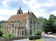
Crécy-la-Chapelle is a commune in the Seine-et-Marne department in the Île-de-France region in north-central France.
Contents
- G te les iris cr cy la chapelle france
- Map of 77580 CrC3A9cy la Chapelle France
- Situation
- Others localities
- Demographics
- Politics and administration
- Spots and monuments
- References
Map of 77580 Cr%C3%A9cy-la-Chapelle, France
Situation
Crécy-la-Chapelle is crossed by the river Grand Morin. The ground of the area is limestone.
Others localities
Crécy Bourg, Montbarbin, Serbonne, la Chapelle-sur-Crécy, Libernon, Mongrolle, Férolles, Montaudier, la Grand-Cour, les Hauts-Soleil, le Choisiel, le Souterain, Montpichet
Demographics
The inhabitants are called Créçois.
Politics and administration
The town is twinned with Pielenhofen
Spots and monuments
References
Crécy-la-Chapelle Wikipedia(Text) CC BY-SA
