
Founded September 11, 1951 Time zone PET (UTC-5) Elevation 2,951 m | Region Cusco Capital Coya UBIGEO 080402 Area 71.43 km² | |
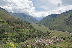 | ||
Coya District is one of eight districts of the Calca Province in the Cusco Region of Peru.
Contents
Map of Coya, Peru
Geography
Some of the highest mountains of the district are listed below:
Ethnic groups
The people in the district are mainly indigenous citizens of Quechua descent. Quechua is the language which the majority of the population (79.19%) learnt to speak in childhood, 20.66% of the residents started speaking using the Spanish language (2007 Peru Census).
References
Coya District Wikipedia(Text) CC BY-SA