
Country Canada Census division 2 Elevation 1,070 m (3,510 ft) Area 98 ha Local time Tuesday 8:27 AM | Time zone MST (UTC−7) Population 245 (2016) Province Alberta | |
 | ||
Weather -12°C, Wind N at 16 km/h, 84% Humidity | ||
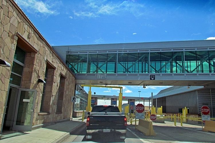
Coutts /ˈkuːts/ is a village in Alberta and a port of entry into the U.S. state of Montana. It is one of the busiest ports of entry on the Canada–United States border in western Canada. It connects Highway 4 to Interstate 15, an important trade route (CANAMEX Corridor) between Alberta, American states along I-15, and Mexico.
Contents
Map of Coutts, AB, Canada
The community has the name of William Burdett-Coutts, a railroad official.
In 2004, a joint border facility opened in Coutts–Sweet Grass, Montana, housing both Canadian and American federal authorities.
Demographics
In the 2016 Census of Population conducted by Statistics Canada, the Village of Coutts recorded a population of 245 living in 122 of its 159 total private dwellings, a change of 2998884000000000000♠−11.6% from its 2011 population of 277. With a land area of 1.24 km2 (0.48 sq mi), it had a population density of 197.6/km2 (511.7/sq mi) in 2016.
In the 2011 Census, the Village of Coutts had a population of 277 living in 123 of its 154 total dwellings, a change of −9.2% from its 2006 population of 305. With a land area of 0.98 km2 (0.38 sq mi), it had a population density of 282.7/km2 (732.1/sq mi) in 2011.