
Country Canada Census division No. 11 Incorporated 1958 (County) Population 11,181 (2016) Province Alberta | Region Central Alberta Established 1943 Time zone MST (UTC-7) Local time Tuesday 5:03 AM | |
 | ||
Weather -17°C, Wind NW at 13 km/h, 80% Humidity | ||
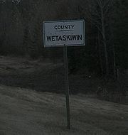
The County of Wetaskiwin No. 10 is a municipal district in central Alberta, Canada, south of Edmonton. Located in Census Division No. 11, its municipal office is in located in the City of Wetaskiwin.
Contents
Map of Wetaskiwin County No. 10, AB, Canada
Demographics
In the 2016 Census of Population conducted by Statistics Canada, the County of Wetaskiwin No. 10 recorded a population of 11,181 living in 4,372 of its 5,556 total private dwellings, a 7000290000000000000♠2.9% change from its 2011 population of 10,866. With a land area of 3,132.06 km2 (1,209.30 sq mi), it had a population density of 3.6/km2 (9.2/sq mi) in 2016.
In the 2011 Census, the County of Wetaskiwin No. 10 had a population of 10,866 living in 4,155 of its 5,025 total dwellings, a 3.3% change from its 2006 adjusted population of 10,519. With a land area of 3,129.4 km2 (1,208.3 sq mi), it had a population density of 3.5/km2 (9.0/sq mi) in 2011.
In 2006, the County of Wetaskiwin No. 10 had a population of 10,535 living in 4,561 dwellings, a 1.5% decrease from 2001. The county has a land area of 3,130.90 km2 (1,208.85 sq mi) and a population density of 3.4/km2 (8.8/sq mi).
In 2001, the municipal district had a population of 10,695 in 4,670 dwellings, a 2.2% increase from 1996. On a surface of 3,131.86 km² it had a density of 3.4 inhabitants/km².