
OS grid reference TF013198 Post town Grantham | Sovereign state United Kingdom Postcode district NG33 | |
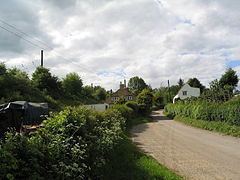 | ||
The flying scotsman passing through counthorpe
Counthorpe is a hamlet in the civil parish of Counthorpe and Creeton in the South Kesteven district of Lincolnshire, England. It adjoins the hamlet of Creeton and lies 5 miles (8 km) south-west from Bourne and 3 miles (5 km) south from Corby Glen, and on the River Glen.
Contents
- The flying scotsman passing through counthorpe
- Map of Counthorpe Grantham UK
- Quadtrac at counthorpe
- References
Map of Counthorpe, Grantham, UK
In the Domesday account Counthorpe is written as "Cudetorp". Before the Conquest lordship was held by Earl Morcar; after, Drogo of la BeuvriËre became Tenant-in-chief.
Counthorpe shares the Grade I listed Anglican parish church at Creeton, dedicated to St Peter. The church is of late Decorated style. A restoration of 1851 discovered the arches and piers of a former Norman aisle. The church holds a chained bible from 1611. Two examples of Saxon crosses stand in the churchyard, with 20 stone coffins considered to mark the interment of Cistercian monks of Vallis Dei abbey in the neighbouring parish of Edenham.
Counthorpe was formerly a hamlet of Castle Bytham and had, up to the 16th century, its own parochial chapel, but was annexed to Creeton in 1860.