
Population 838 Sovereign state United Kingdom Dialling code 01234 | OS grid reference TL084404 Post town BEDFORD | |
 | ||
Cotton End is a small village located near the centre of the Eastcotts parish (where the 2011 Census population was included) on the outskirts of Bedford.
Map of Cotton End, Bedford, UK
Officially, Cotton End is one of the villages of Eastcotts, and is the centre-most settlement within the civil parish. Ordnance Survey maps from the 1880s show its name as 'Cardington Cotton End'.
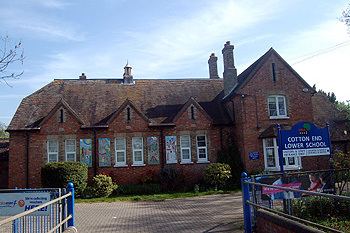
There is a primary school, a Bapist Church, a village hall and a pub.
The Baptist chapel was founded here in 1777. In 1912, Cotton End was described as a scattered hamlet with a school and a farm. It lies further down the A600 road from Shortstown.
A new woodland created by the Forest of Marston Vale in 2005 called Shocott Spring.
References
Cotton End Wikipedia(Text) CC BY-SA