
Country Honduras Highest elevation 2,242 m (7,356 ft) Time zone -6 Population 1.622 million (2015) | Lowest elevation 0 m (0 ft) Area 3,923 km² Municipalities 12 | |
 | ||
Clubs and Teams Real C.D. España, Platense F.C., C.D. Marathón, Palestino F.C. Points of interest Lake Yojoa, Museo de Antropologia e Historia, Museo San Fernando de Omoa, Zoo Joya Grande, Zizima Eco Water Park Colleges and Universities Universidad Tecnológica de Hondu, Universidad Católica de Honduras, University of San Pedro Sula, Universidad Tecnológica de Hondu | ||
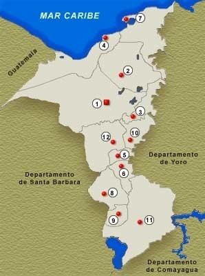
Cortés is one of the 18 departments into which Honduras is divided. The department covers a total surface area of 3,954 km² and, in 2015, had an estimated population of 1,612,762 people, making it the most populous department in Honduras. The Merendón Mountains rise in western Cortés, but the department is mostly a tropical lowland, the Sula Valley, crossed by the Ulúa and Chamelecon rivers.
Contents
Map of Cort%C3%A9s, Honduras
It was created in 1893 from parts of the departments of Santa Bárbara and Yoro. The departmental capital is San Pedro Sula. Main cities also include Choloma, La Lima, Villanueva, and the sea ports of Puerto Cortés and Omoa. The Atlantic coast of the Department of Cortés is known for its many excellent beaches.
Cortés is the economic heartland of Honduras, as the Sula Valley is the country's main agricultural and industrial region. US banana companies arrived in the area in the late 19th Century, and established vast plantations, as well as infrastructure to ship the fruit to the United States. San Pedro Sula attracted substantial numbers of European, Central American, and Palestinian and Lebanese immigrants. Industry flourishes in the department, and Cortés today hosts most of the country's assembly plants, known as maquilas.
Municipalities
- Choloma
- La Lima
- Omoa
- Pimienta
- Potrerillos
- Puerto Cortés
- San Antonio de Cortés
- San Francisco de Yojoa
- San Manuel
- San Pedro Sula
- Santa Cruz de Yojoa
- Villanueva