Girish Mahajan (Editor)

Coronel Suárez Partido

Updated on
Edit
Like
Comment
Share on FacebookTweet on TwitterShare on LinkedInShare on Reddit
Country
  
Argentina

Founded by
  
Eduardo Casey

Demonym(s)
  
suarense

Established
  
May 28, 1883

Seat
  
Coronel Suárez

Postal Code
  
B7540

Coronel Suárez Partido

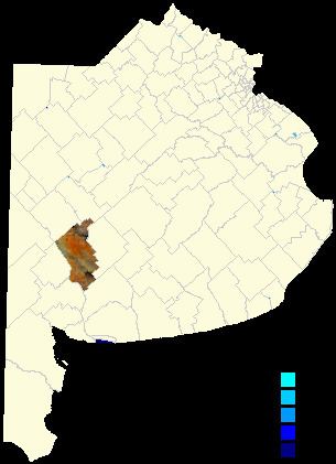
The partido of Coronel Suárez (German: Partido Oberst Suárez) is a subdivision of the Province of Buenos Aires in Argentina. Located in the south-central part of the province, it was created in 1882 by the provincial government when they divided the territory of Tres Arroyos into the partidos of Coronel Suárez, Tres Arroyos and Coronel Pringles.

Contents

Map of Cnel Suar%C3%A9z, Buenos Aires Province, Argentina

It has a population of about 37,000 inhabitants in an area of 6,000 km2 (2,317 sq mi), and its capital city is Coronel Suárez, which is 550 km (342 mi) from Buenos Aires.

Its population is mainly of Volga German descent.

Settlements

  • Coronel Suárez, 22,311
  • Huanguelén, pop.4,955, 56 km (35 mi) from Suárez
  • Santa Trinidad, pop.1,859
  • San José, pop.2,127
  • Santa María, pop.1,770
  • Villa Arcadia, pop.305
  • Pasman, 208, 37 km (23 mi) from Suárez
  • Curamalal, 104, 22 km (14 mi) from Suárez
  • D'Orbigny, 49, 40 km (25 mi) from Suárez
  • Cascada, 16, 52 km (32 mi) from Suárez
  • Quiñihual, 57 km (35 mi) from Suárez
  • Bathurts, 20 km (12 mi) from Suárez
  • Ombú, 49 km (30 mi) from Suárez
  • Primavera, 18 km (11 mi) from Suárez
  • Otoño, 71 km (44 mi) from Suárez
  • Piñeyro, 18 km (11 mi) from Suárez
  • Zoilo, 94 km (58 mi) from Suárez
  • Airfield

  • Brig D Hector Eduardo Ruiz (SAZC)
  • Elevation: 234 m (768 ft)
  • Paved runway, coordinates: 37°26'46"S 61°53'21"W
  • Runways: One paved runway, 1,318 m (4,324 ft) × 27 m (89 ft)
  • References

    Coronel Suárez Partido Wikipedia