
Founded 1960 Highest elevation 10 m (30 ft) | District 6th district of Cebu Barangay Area 17.15 km² Local time Monday 5:08 PM | |
 | ||
Weather 28°C, Wind N at 14 km/h, 73% Humidity Neighborhoods Buagsong, Alegria, Catarman Points of interest Mactan, Nalusuan, Cebu Happy World Mu, Cebu Happyworld Museum, Parkside Alta Cebu Resort | ||
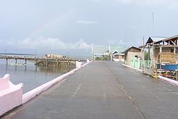
Cordova (also spelled Cordoba) is a 3rd municipal income class municipality in the province of Cebu, Philippines. Most of Cordova lies on separate islands off the southern coast of Mactan Island. It is connected to the main island of Mactan by two bridges with a third to be opened by 2020.
Contents
- Map of Cordova Cebu Philippines
- History
- Geography
- Climate
- Barangays
- Demographics
- Tourism
- Education
- References
Map of Cordova, Cebu, Philippines
According to the 2015 census, it has a population of 59,712. In the 2016 electoral roll, it had 34,273 registered voters.
History
Cordova is not the original name of the territory it represents, and neither is it named for the city of Cordoba, Spain. On 22 May 1863, Governor General Rafael Echague created a new town comprising the barrios of Gabi, Day‑as and Pilipul (now called Pilipog), all of which are located on the southeastern tip of Mactan Island. He chose the name Cordoba which means "stark nakedness and bare".
Cordova became a municipality in 1864, and from 1913 up to the present, a total of 15 mayors governed the district.
Geography
Geographically, Cordova consists of a main island, bordering on and separated from Mactan Island by a narrow stream, as well as the islets of Gilutongan (also spelled Hilutungan), Nalusuan, Shell, Tongo and Lava. The two islets of Gilutongan and Nalusuan are part of the Olango Island Group in the middle of the Cebu Strait. Its land area is 789.6 hectares (1,951 acres), of which 740.85 hectares (1,830.7 acres) constitutes the main island and 48.75 hectares (120.5 acres) are outlying islets.
The surface of the town consists entirely of karstic limestone rock geologically associated with the Plio-Pleistocene Carcar Formation, dated to 2½–3 million years ago. The topography of Cordova is flat land, the highest point being only 10 metres (33 ft) above sea level.
Climate
The climate of Cordova is of Coronas type III, meaning the seasons are not very pronounced and are classified as hot and humid.
Its temperature ranges from 18 to 35 °C (65 to 95 °F), with a mean high temperature of 31 °C (88 °F) and a mean low of 23 °C (74 °F).
Barangays
Cordova comprises 13 barangays:
Demographics
In the 2016 electoral roll, it had 34,273 registered voters, meaning that 57% of the population are aged 18 and over.
Tourism
Cordova has six hotels and resorts, while some tourist areas include:
A special attraction is the mangrove forest and swamp area. The best access to this area is the Day-as Boardwalk and Marine Park. The total mangrove plantation is estimated to cover more or less one hundred hectares (250 acres). Most of the mangrove forest is located in the barangays of Pilipog, Bangbang, San Miguel, Day‑as and Catarman.
Education
The children in Cordova are served by 14 day-care centers, eleven public elementary schools, two private elementary schools, one public high school, a private high school and the public college. Educational achievement is relatively high, with 75% of adults (i.e. 21 years old and above) having finished elementary and high school and 23% have attended university or received a degree. Around 2% of the population report not having received formal schooling.