
Peak Mont Shipton Mountains Monte Bove | State Magallanes Region | |
 | ||
Similar Monte Sarmiento, Mount Darwin, Alberto de Agostini National, Beagle Channel, Strait of Magellan | ||
Expedici n fotogr fica cordillera darwin tierra de fuego
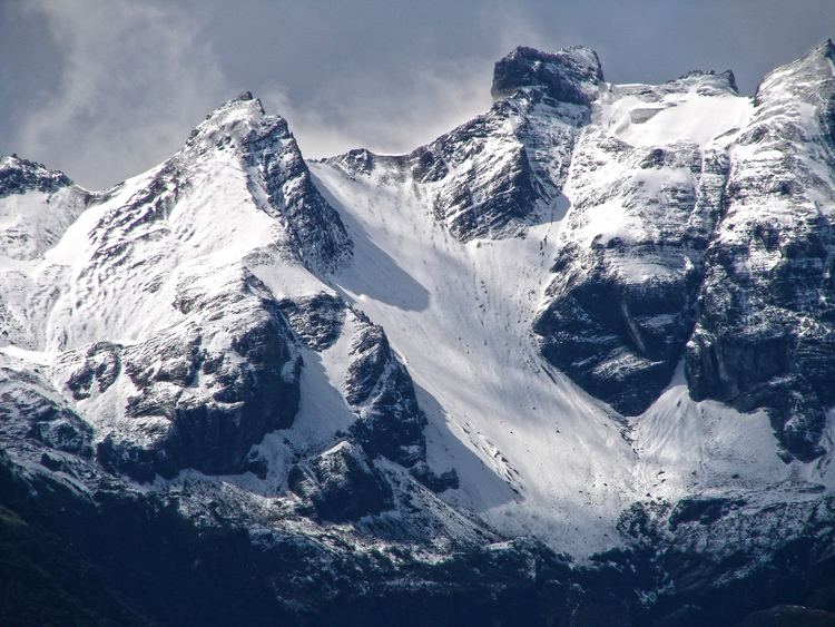
The Cordillera Darwin is an extensive mountain range mantled by an ice field that is located in Chile.
Contents
- Expedici n fotogr fica cordillera darwin tierra de fuego
- Map of Cordillera Darwin Cabo de Hornos Magallanes y la AntC3A1rtica Chilena Region Chile
- Cordillera darwin traves a hist rica
- Description
- Major peaks
- References
Map of Cordillera Darwin, Cabo de Hornos, Magallanes y la Ant%C3%A1rtica Chilena Region, Chile
Cordillera darwin traves a hist rica
Description
It is located in the southwestern portion of Isla Grande de Tierra del Fuego, entirely within the Chilean territory. It is part of the longest Andes range and includes the highest mountains in Tierra del Fuego, with elevations reaching over 2,000 m (6,600 ft); The ice field of the Cordillera Darwin covers an area greater than 2,300 square kilometres (890 sq mi). The Darwin Range extends in a west-east direction from the Monte Sarmiento (located in the vicinity of Magdalena Channel) to Yendegaia Valley. It is bounded by the Almirantazgo Fjord on the north and the Beagle Channel on the south. The range is named after Charles Darwin and is the most important feature of Alberto de Agostini National Park, which includes a number of well-known glaciers including the Marinelli Glacier, which is now under prolonged retreat as of 2008.
In October 2011, a team of French mountaineers from the French Army's Groupe Militaire de Haute Montagne announced the first crossing of the Cordillera Darwin in a 29-day trip which included an ascent of Mount Darwin, the highest peak in the range.