
Type reservoir Built 1963—1973 Surface elevation 154 m Length 115.9 km | Primary inflows Basin countries United States Area 48.4 km² Mean depth 6.1 m Catchment area 20,969 km² Inflow source Cumberland River | |
 | ||
Managing agency | ||
Cordell Hull Lake is a lake in the Cumberland River in north-central Tennessee, about forty miles east of Nashville, in the vicinity of Carthage. It covers approximately 12,000 acres (49 km2).
Map of Cordell Hull Reservoir, Tennessee 37030, USA
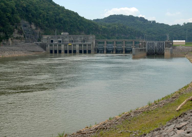
Cordell Hull Dam, on the Cumberland River, was built by the United States Army Corps of Engineers between May 1963 and November 1973 for navigation, hydroelectric power generation and recreation. The dam is a concrete and earthen gravity structure, 87 feet high (above streambed), with a generator capacity of 100 megawatts. It impounds 259,100 acre feet (0.3196 km3) at normal maximum pool, with a maximum flood storage of 310,900 acre feet (0.3835 km3).
Both are named for Cordell Hull, former United States Secretary of State.
References
Cordell Hull Lake Wikipedia(Text) CC BY-SA