
- elevation 315 m (1,033 ft) - elevation 147 m (482 ft) | ||
 | ||
- left | ||
The Cordeaux River, a perennial river of the Hawkesbury-Nepean catchment, is located in the Southern Highlands and Macarthur regions of New South Wales, Australia.
Contents
Map of Cordeaux River, New South Wales, Australia
Course
The Cordeaux River rises on the western slopes of the Illawarra escarpment, below Mount Keira within the Wollongong local government area and flows generally north and northwest, joined by the Avon River, before reaching its confluence with the Nepean River, south of Wilton. The river descends 168 metres (551 ft) over its 37-kilometre (23 mi) course.
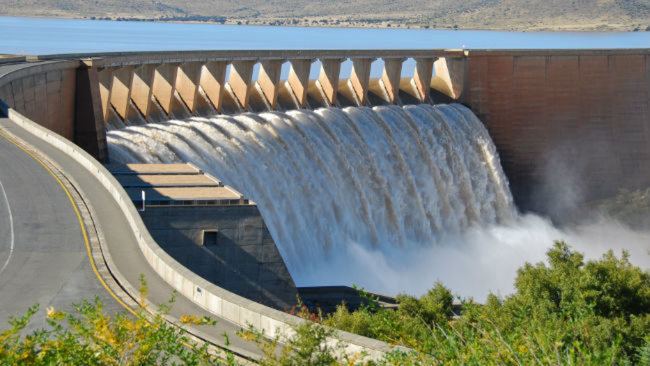
The river is impounded by Lake Cordeaux, one of four reservoirs within the Upper Nepean Scheme that supplies potable water for greater metropolitan Sydney. Located near Ryans Crossing, approximately 94 kilometres (58 mi) south-west of Sydney, construction of the dam wall on the Cordeaux River commenced in 1918 and was completed in 1926.