
OS grid reference SU308147 Sovereign state United Kingdom Dialling code 023 | Civil parish Copythorne Local time Monday 6:13 AM | |
 | ||
Weather 2°C, Wind NW at 3 km/h, 96% Humidity | ||
Copythorne is a village and civil parish situated in Hampshire, England, within the boundaries of the New Forest National Park.
Contents
Map of Copythorne, Southampton, UK
Overview
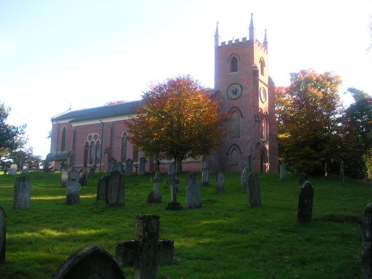
Copythorne is in the north-eastern part of the New Forest, in Hampshire, England. The village is on the A31 Romsey Road, just south of the M27 motorway which splits the parish in two halves. There is an Anglican parish church dedicated to Saint Mary, an Infants School, and a hall.
The parish contains the villages of Cadnam, Bartley, Winsor, Newbridge, and Ower. To the north of the village is Copythorne Common; parts of Cadnam Common and Furzley Common are also in the parish, as well as Shelly Common in the far north of the parish. There is woodland in the south and north of the parish, and Paultons Park – an old estate with a modern theme park – is also in the parish.
History
Copythorne is first recorded as Coppethorne in the 14th century. The name means "Cropped (haw)thorn", which relates to the practice of pollarding trees to provide feed for animals.
There are several Bronze Age barrows in the parish, locally called "Money Hills". At approximately the site of the present church, the Roman road from Nursling suddenly turned south towards Cadnam roundabout.
In the middle ages much of the land in the area was part of the monastic estates of Amesbury, Netley, and Glastonbury. After the Dissolution many of these lands become part of the Paultons estate.
Saint Mary's Church in Copythorne is a red brick structure built in 1834, with alterations made around 1891-2. The civil parish of Copythorne was one of those created out of the ancient parish of Eling in 1894.