
Population 281 (2011 census) Parish Cooyar Local time Monday 10:21 AM | Postcode(s) 4402 County Cavendish Postal code 4402 | |
 | ||
Weather 28°C, Wind SW at 16 km/h, 49% Humidity | ||
Cooyar is a town in the Darling Downs region of Queensland, Australia. The town is on the New England Highway and in the Toowoomba local government area, 204 kilometres (127 mi) north west of the state capital, Brisbane. At the 2011 census, Cooyar and the surrounding area had a population of 281.
Contents
Map of Cooyar QLD 4402, Australia
History
Cooyar Post Office opened by March 1907 (a receiving office had been open from 1904).
Attractions
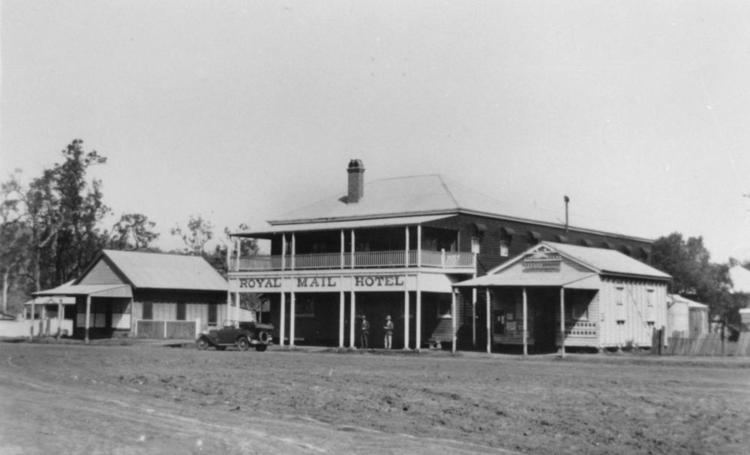
There are many interesting sites at Cooyar. They include: the Swinging Bridge, a memorial park with playground, a family-friendly pub, an ANZAC Memorial, once a week a man with a stall selling fruit and vegetables, a showground which holds events like endurance riding and an annual show (with a brilliant rodeo at night), a hall which is used regularly by the locals, the local shop which sells hot and cold food, assorted groceries, car related goods, reading material and a post office with a letterbox.
Library services in Cooyar are provided by the Toowoomba Regional Council's mobile library service. The van visits Cooyar State School and Cooyar Park (McDougal Street) on the 1st and 3rd Tuesday of each month.
Heritage listings
Cooyar has a number of heritage-listed sites, including: