
Population 16 (?) Mean max temp Mean min temp Local time Monday 9:51 AM | Postcode(s) 3477 Postal code 3477 Federal division Division of Murray | |
 | ||
Location 263 km (163 mi) NW of Melbourne108 km (67 mi) W of Bendigo125 km (78 mi) E of Horsham17 km (11 mi) N of St Arnaud Weather 21°C, Wind SE at 21 km/h, 57% Humidity | ||
Coonooer Bridge is a township in western Victoria. The town is in the Shire of Buloke, 263 kilometres (163 mi) north west of the state capital, Melbourne.
Map of Coonooer Bridge VIC 3477, Australia
Coonooer Bridge Methodist Church was built in 1875 and still stands today as one of the oldest buildings in the shire.
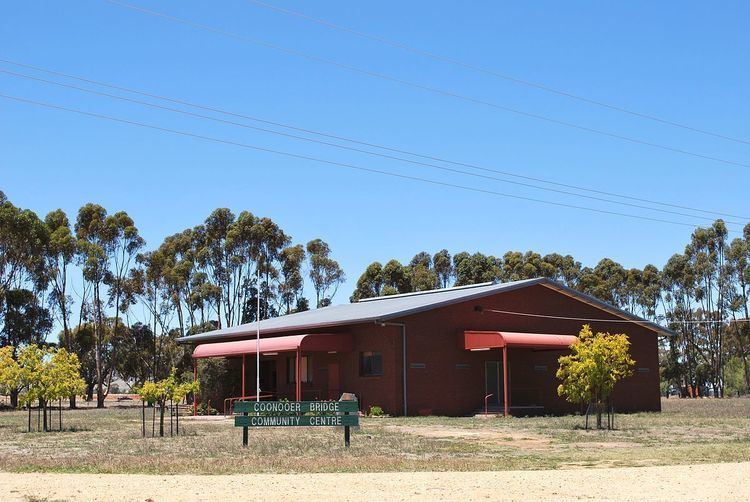
The Coonooer Bridge Community Centre was built in 1984 and opened in October of that year. It was built on the site of the Coonooer Bridge State School which closed in 1964.
A War Memorial erected by local citizens in 1920 commemorates servicemen and women from the local area serving in the Great War and World War 2.
Coonooer Bridge Post Office opened around January 1879 and closed in 1966. A Conover (an alternative spelling of Coonooer) office was open nearby between 1873 and 1895.