
Population 174 (2011 census) Postal code 4311 | Postcode(s) 4311 | |
 | ||
Coolana is a rural suburb of Somerset Region, Queensland, Australia. At the 2011 Australian Census Coolana recorded a population of 174.
Map of Coolana QLD 4311, Australia
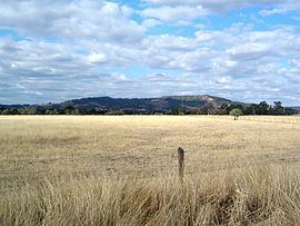
Coolana lies in the west of the Lockyer Creek catchment area. Part of the northern boundary of Coolana follows Plain Creek at tributary of Lockyer Creek. The east of the suburb rises towards the peak of Mount Stradbroke. Lowood Minden Road traveses the locality from north to south. Parts of the area are used for agriculture while much of the land is undeveloped.
References
Coolana, Queensland Wikipedia(Text) CC BY-SA