
Postcode(s) 2843 Postal code 2843 Local time Monday 8:49 AM | Founded 1840 Population 798 (2006) | |
 | ||
Weather 19°C, Wind E at 8 km/h, 76% Humidity | ||
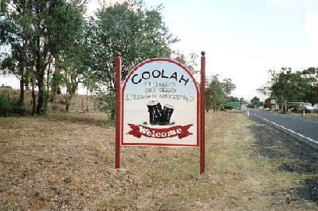
Coolah is a town in the central western part of New South Wales, Australia in Warrumbungle Shire. At the 2006 census, Coolah had a population of 910.
Contents
Map of Coolah NSW 2843, Australia
On the northeastern side of the area is the Liverpool Range with the Coolah Tops National Park. Most of the region is agricultural with sheep and cattle raising and crops grown along the Talbragar River and Coolaburragundy River valleys.
History
The Coolah area was first settled by pastoralists around 1840.
Coolah Post Office opened on 1 January 1849.
Coolah was served by a branch railway from March 1920 until May 1975.
Cadbury Schweppes introduced a citrus-flavored energy drink in the US in 2006 named Coolah Energy. The text on the packaging for this product refers to the Australian Cadbury Schweppes product Solo as its inspiration, along with the lifestyle of the inhabitants of the town of Coolah.
Coolah is the location of the first Australian memorial commemorating The Battle of Long Tan. A total of 18 trees were planted along Coolah's Vietnam Memorial Avenue, one for each Australian soldier killed during the battle.
Industry
From the Coolah Energy drink can: