
Barangays ZIP code 3807 | District Lone District Time zone PST (UTC+8) Area 694.3 km² Local time Sunday 6:55 AM | |
 | ||
Weather 22°C, Wind S at 2 km/h, 93% Humidity Neighborhoods Paddaoan, Santa Cruz, Buneg, Siuan, Malama, Tauinin | ||
Conner, officially the Municipality of Conner (Ilocano: Ili ti Conner; Filipino: Bayan ng Conner), is a municipality in the province of Apayao in the Cordillera Administrative Region (CAR) of the Philippines. The population was 26,051 at the 2015 census. In the 2016 electoral roll, it had 12,961 registered voters.
Contents
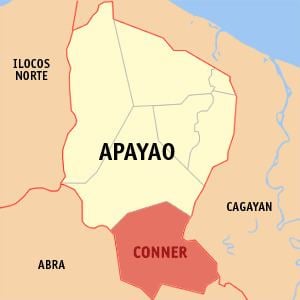
Map of Conner, Apayao, Philippines
Geography
Conner is located at 17°48′N 121°20′E.
According to the Philippine Statistics Authority, the municipality has a land area of 694.30 square kilometres (268.07 sq mi) constituting 7001157300000000000♠15.73% of the 4,413.35-square-kilometre- (1,704.00 sq mi) total area of Apayao.
Barangays
Conner is politically subdivided into 21 barangays.
Demographics
In the 2015 census, Conner had a population of 26,051. The population density was 38 inhabitants per square kilometre (98/sq mi).
In the 2016 electoral roll, it had 12,961 registered voters.