
Existed: 1933-34 – present Length 3.57 km | ||
 | ||
County | ||
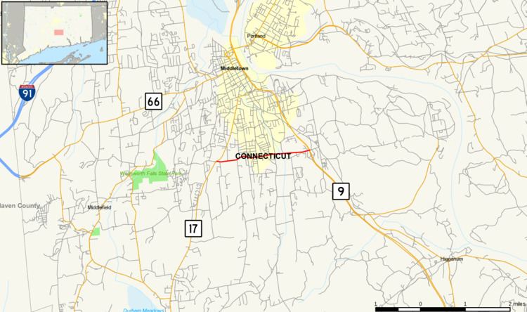
Route 155 is a Connecticut state highway running entirely within the city of Middletown. It is primarily used as a connector between the Route 9 expressway and Route 17 towards Durham.
Contents
Map of CT-155, Middletown, CT 06457, USA
Route description
Route 155 begins at an intersection with Route 17 in southern Middletown. It proceeds east through residential areas for about 2.1 miles (3.4 km) towards Route 9, crossing over Sumner Brook and Mill Brook along the way. Route 155 officially ends at the end of the northbound Route 9 Exit 11 off-ramp, which is about 100 yards (91 m) east of the Route 9 underpass. The entire length of Route 155 is known as Randolph Road. Randolph Road continues east for another 0.2 miles (0.32 km) as a local road to Saybrook Road, which was the pre-expressway alignment of Route 9. Route 155 is a minor arterial road and carries traffic volumes of about 10,100 per day.
History
Route 155 was commissioned in 1933 or 1934 as an additional connection between Routes 9 and 17. The eastern terminus has since been shifted from Saybrook Road to the current location, when Route 9 was moved to its expressway alignment in 1967. The Route 155 exit off Route 9 is now signed as the route for Durham.
Junction list
The entire route is in Middletown, Middlesex County.