
Bridges Puente Dos Hermanos | ||
 | ||
Governing body Department of Natural Resources | ||
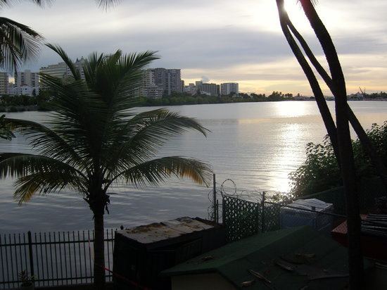
San juan puerto rico condado lagoon hd 2015
Condado Lagoon (Laguna del Condado in Spanish) is located in San Juan, Puerto Rico. It is an affluent body of water that flows freely between the Condado and Miramar neighborhoods of Santurce, a sector of San Juan.
Contents
- San juan puerto rico condado lagoon hd 2015
- Map of Laguna del Condado San Juan 00907 Puerto Rico
- Background
- Geography
- Endangered species
- Nearest beach
- References
Map of Laguna del Condado, San Juan, 00907, Puerto Rico
Background
Its tributary stream of water forms part of the San Juan Bay Estuary. An estuary is a coastal area where fresh water from rivers and other inland water sources mixes with salt water from the ocean. The Metropolitan Area of Puerto Rico is intersected by estuarine bodies of water, such as Condado Lagoon, Martín Peña Channel, San José Lagoon and Piñones Lagoon, among others. The Cucharillas Marsh is another part of this urban ecosystem. Condado Lagoon empties into the Atlantic Ocean through El Boquerón, an inlet spanned by the Dos Hermanos Bridge through the San Antonio Creek. It is one of two natural lagoons in San Juan, Puerto Rico.