
 | ||
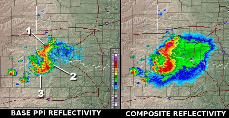
The composite reflectivity is the maximum dBZ reflectivity from any of the reflectivity angles of the NEXRAD weather radar. The reflectivity on individual PPI angles show the precipitation intensity at that specific angle above the horizon. Some of these angles are .5, 1.45, 2.4, and 3.35 degrees with the Doppler radar having up to 14 angles when it's in Severe Mode. In the Composite, the highest intensities amongst those available in the different angles above each point of the image will be displayed. In the Canadian weather radar network, this is called MAXR, for Maximum reflectivity in the column.
Use
When compared to the base angle reflectivity, the lowest angle of elevation sounding, the composite reflectivity, including higher elevation scan information, may appear to indicate more widespread rain. This could indicate one of two things: