Governing body U.S. Forest Service Established December 19, 2014 | Area 180.9 km² | |
 | ||
Location Taos County, New Mexico, United States Management United States Forest Service | ||
Chuck howe supports the columbine hondo wilderness act
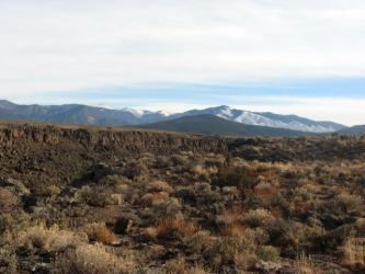
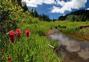
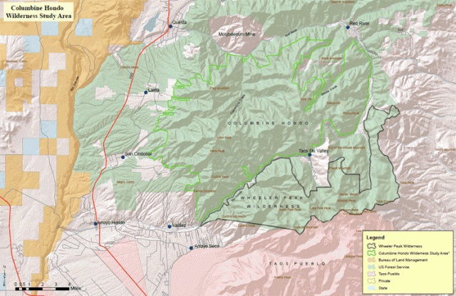
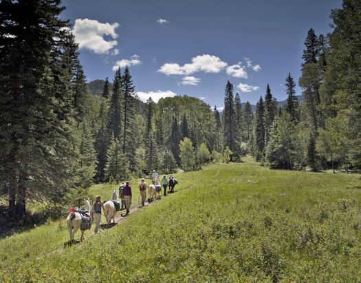
Columbine-Hondo Wilderness is a 44,698-acre (18,089 ha) Wilderness area located within the Carson National Forest in New Mexico. The area was added to the National Wilderness Preservation System on December 19, 2014 by Public Law 113-291. Located in the Sangre de Cristo Mountains, this area contains the headwaters to the Rio Hondo and Red River as well as three peaks which rise to or above timberline.
Contents
- Chuck howe supports the columbine hondo wilderness act
- Judi cantu supports the columbine hondo wilderness act
- History
- References
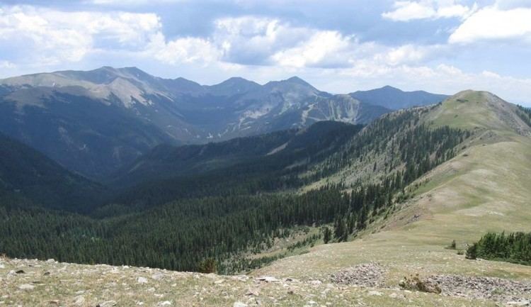
Elevations in the wilderness range from 2,396 metres (7,861 ft) to 3,874 metres (12,710 ft) at Gold Hill. The other principal summits of the wilderness area are Lobo Peak (3,692 metres (12,113 ft)) and Flag Mountain (3,641 metres (11,946 ft)). The Colombine-Hondo Wilderness is separated from the Wheeler Peak Wilderness to the south only by Highway 150 and the Taos Ski Valley. Latir Peak Wilderness is located north of Colombine- Hondo Wilderness.
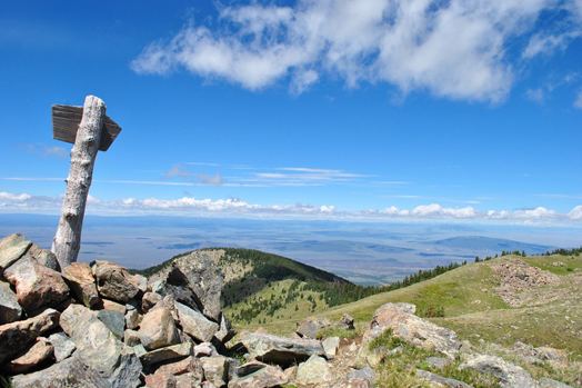
The wilderness has vegetation typical of the southern Rocky Mountains with Ponderosa Pine and Pinyon forests at lower elevations, mixed conifers and aspens at the middle elevations, spruce-fir forests at higher elevations, and alpine tundra above treeline.
Judi cantu supports the columbine hondo wilderness act
History
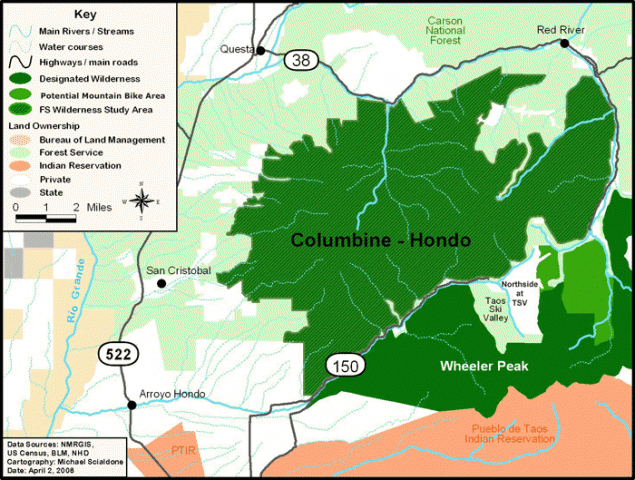
Columbine-Hondo was designated a Wilderness Study Area by congress in 1980. In April 2012, Senator Jeff Bingaman unsuccessfully introduced a bill (S.2468) to designate the area as wilderness. The bill (S.776) was re-introduced by Senators Martin Heinrich and Tom Udall in April 2013 followed by an identical house bill (H.R.1683) introduced by Representative Ben Ray Luyán. The bill was signed into law on December 19th, 2014.