
Country United States Area code(s) 205 Elevation 160 m Population 4,208 (2013) | Time zone Central (CST) (UTC-6) FIPS code 01-16768 Zip code 35051 Local time Wednesday 7:49 PM | |
 | ||
Weather 12°C, Wind SW at 0 km/h, 56% Humidity | ||
30th annual liberty day 2016 parade in columbiana alabama 1080i
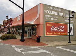
Columbiana is a city in Shelby County, Alabama, United States. At the 2010 census the population was 4,197. The city is the county seat of Shelby County.
Contents
- 30th annual liberty day 2016 parade in columbiana alabama 1080i
- Map of Columbiana AL 35051 USA
- History
- Geography
- City Government
- Elected Officials
- Demographics
- 2010 census
- Education
- 1932 Tornado outbreak
- Notable people
- References
Map of Columbiana, AL 35051, USA
History
Columbiana, originally called Columbia, was selected as the county seat of Shelby County in 1826 over rivals Calera and Montevallo. After the selection as the county seat, Columbiana celebrated by drilling holes in a large pine tree and packing it with gunpowder. The tree was blown up and the sound could be heard for miles. Later in 1826, the courthouse was moved to an old school building in Columbiana.
An act of the Alabama Legislature officially changed the name of Shelby County’s county seat to Columbiana on January 13, 1832. Columbiana was incorporated on December 5, 1837 with corporate limits one-quarter of a mile in each direction from the public square.
In 1854, the decision was made to build a larger courthouse at the south end of “Silk Stocking Road”, now Main Street. From 1854 to 1908 several additions and changes were made to the courthouse. During the American Civil War, Columbiana was connected to the nearby town of Shelby by the Shelby Iron Company Railroad, which connected the Shelby Iron Works to the Alabama and Tennessee River Railroad. The Iron Works supplied iron to the C.B. Churchill and Company foundry, which moved to Columbiana in 1862 after the fall of Corinth, Mississippi. The Churchill foundry made eight and ten pound shot, eight and ten pound shells, and shells for Blakely rifles. The C.B. Churchill and Company foundry, Shelby Iron Works and the railroad were destroyed by Union forces on March 31, 1865, as part of Wilson's Raid.
Moving the courthouse to Columbiana was not necessarily popular in 1826 and there have been numerous attempts to relocate the county seat over the years. In 1901, the Alabama Constitutional Convention addressed the issue by including Section 41 in the new state constitution. Section 41 prohibited a move of the Shelby County seat from Columbiana unless a vote of the people was held, the only county in Alabama with such a designation.
To further solidify Columbiana’s claim to the county seat, in 1905 construction began two blocks north of the existing courthouse on a new marble courthouse at a cost of $300,000. The new courthouse was completed in 1908 and has been renovated and enlarged on a number of occasions. The new courthouse has served Shelby County for over 100 years.
The “Old Courthouse” is now home to the Shelby County Museum and Archives.
Today, Columbiana is home to the Shelby County Board of Education, the Shelby County Sheriff's Office, the Shelby County Jail, and Harrison Regional Library, which is the main office for the Shelby County Library System. Columbiana holds the annual Liberty Day celebration on the last weekend in June, which was first held in 1986 to honor the 100th anniversary of the Statue of Liberty. The current mayor is Dr. Stancil Handley.
Geography
Columbiana is located at 33°11′1″N 86°36′34″W (33.183545, -86.609365).
According to the U.S. Census Bureau, the city has a total area of 15.2 square miles (39.4 km2), of which 15.2 square miles (39.3 km2) is land and 0.04 square mile (0.1 km2) (0.26%) is water.
City Government
Columbiana is a municipal corporation organized under the laws of the State of Alabama. The city is located in Shelby County, Alabama, which is approximately 25 miles (40 km) southeast of Birmingham. According to the 2010 census conducted by the U.S. Department of Commerce, the population of Columbiana was 4,197. There are 16.86 square miles (43.7 km2) within the corporate limits of Columbiana.
Columbiana is governed under the mayor-council form of government. The mayor is elected on an at-large basis for a four-year term and the five council members are elected from single member districts, each for a four-year term. The mayor and council serve on a part-time basis. The mayor serves as chief executive officer of the City and is responsible for the daily operations of all departments of the City. The council acts as the legislative branch of the City.
Municipal operations are financed largely by sales tax, utility revenues, privilege licenses and property taxes.
Elected Officials
Mayor Dr. Stancil Handley, Councilmember Leslie Whiting (District 1), Councilmember Barbara Moore (District 2), Councilmember Ricky Ruston (District 3), Councilmember Kim King (District 4), Councilmember Ouida Mayfield (District 5).
Demographics
As of the census of 2000, there were 3,316 people, 1,260 households, and 868 families residing in the city. The population density was 218.5 people per square mile (84.3/km2). There were 1,372 housing units at an average density of 90.4 per square mile (34.9/km2). The racial makeup of the city was 78.59% White, 19.60% Black or African American, 0.24% Native American, 0.15% Asian, 0.03% Pacific Islander, 0.66% from other races, and 0.72% from two or more races. 1.99% of the population were Hispanic or Latino of any race.
There were 1,260 households out of which 34.0% had children under the age of 18 living with them, 51.8% were married couples living together, 13.4% had a female householder with no husband present, and 31.1% were non-families. 29.2% of all households were made up of individuals and 12.9% had someone living alone who was 65 years of age or older. The average household size was 2.50 and the average family size was 3.10.
In the city, the population was spread out with 25.9% under the age of 18, 8.3% from 18 to 24, 31.6% from 25 to 44, 21.8% from 45 to 64, and 12.4% who were 65 years of age or older. The median age was 36 years. For every 100 females there were 100.5 males. For every 100 females age 18 and over, there were 93.2 males.
The median income for a household in the city was $34,034, and the median income for a family was $44,798. Males had a median income of $34,350 versus $21,193 for females. The per capita income for the city was $18,086. About 8.2% of families and 11.5% of the population were below the poverty line, including 15.3% of those under age 18 and 14.2% of those age 65 or over.
2010 census
As of the census of 2010, there were 4,197 people, 1,303 households, and 874 families residing in the city. The population density was 218.2 people per square mile (84.2/km2). There were 1,445 housing units at an average density of 95.1 per square mile (36.8/km2). The racial makeup of the city was 71.3% White, 25.1% Black or African American, 0.3% Native American, 0.2% Asian, 0.1% Pacific Islander, 1.6% from other races, and 1.3% from two or more races. 3.0% of the population were Hispanic or Latino of any race.
There were 1,303 households out of which 28.4% had children under the age of 18 living with them, 47.5% were married couples living together, 14.7% had a female householder with no husband present, and 32.9% were non-families. 29.7% of all households were made up of individuals and 15.6% had someone living alone who was 65 years of age or older. The average household size was 2.52 and the average family size was 3.12.
In the city, the population was spread out with 19.7% under the age of 18, 9.7% from 18 to 24, 32.2% from 25 to 44, 24.3% from 45 to 64, and 14.1% who were 65 years of age or older. The median age was 37.8 years. For every 100 females there were 121.1 males. For every 100 females age 18 and over, there were 148.9 males.
The median income for a household in the city was $31,108, and the median income for a family was $56,411. Males had a median income of $43,304 versus $34,583 for females. The per capita income for the city was $21,003. About 11.0% of families and 16.2% of the population were below the poverty line, including 29.1% of those under age 18 and 9.2% of those age 65 or over.
Education
Shelby County Schools operates public schools.
1932 Tornado outbreak
In March 1932, Columbiana had a population of 1,180. It was a trading center for the surrounding agricultural areas of Central Alabama. People were optimistic that 1932 would be better than 1931. They didn’t think that 1932 could be any worse than the previous year. The newspapers said that there were definite signs that the economy would be out of the woods by December.
There were no television weather broadcasts, or NOAA weather radio stations in 1932. But people knew the weather was going to be bad that warm, windy and cloudy March 21. As a powerful thunderstorm approached Columbiana during the afternoon, a tornado formed southwest of town about 5:10 p.m. As it reached the western part of the town its path was 200 yards wide.
In the aftermath of the tornado, bits of clothing were left in the trees in the path of destruction. The electrical plant was knocked off line, plunging the city and much of the county into darkness. Darkness and heavy rain hampered rescue efforts. The Columbiana tornado was one of fourteen devastating tornadoes that killed over 300 people across Alabama that day. Fourteen people died in Columbiana in this tornado, which would have likely been rated an EF4 using today's scale.