
ZIP code 35040 Local time Monday 6:41 AM Area code Area code 205 | Time zone CST (UTC-6) Website www.cityofcalera.org Population 12,756 (2013) Number of airports 1 | |
 | ||
Weather 14°C, Wind SE at 11 km/h, 71% Humidity Area 63.2 km² (62.42 km² Land / 78 ha Water) Points of interest Heart of Dixie Railroad Museum, railroad museum, Akridge Arboretum Park | ||
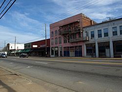
Calera is a city in Shelby and Chilton counties in the U.S. state of Alabama. It is the location of the Shelby County Airport. Calera's population was 3,158 at the 2000 census.
Contents
- Map of Calera AL USA
- Help calera alabama traffic speeding ticket lawyer best calera al traffic attorney
- Geography
- History
- Demographics
- 2010 census
- Notable people
- Points of interest
- Climate
- References
Map of Calera, AL, USA
As of the 2010 census the population had more than tripled to 11,620, making it the fastest-growing city in Alabama. It is within the Birmingham-Hoover, Alabama Metropolitan Statistical Area and positively affected by the growth in its economy.
Help calera alabama traffic speeding ticket lawyer best calera al traffic attorney
Geography
Calera is located in southern Shelby County at 33°06′27″N 86°45′00″W. The city limits extend southward into Chilton County along U.S. Route 31, the main highway through the city. Interstate 65 passes through the eastern side of the city, with access from exits 228, 231, and 234.
According to the United States Census Bureau, the city has a total area of 24.4 square miles (63.1 km2), of which 24.1 square miles (62.4 km2) is land and 0.27 square miles (0.7 km2), or 1.17%, is water.
History
The city of Calera was incorporated in 1887, and named after the Spanish word for "limestone" for all of the limestone deposits located in the area.
Demographics
As of the census of 2000, there were 3,158 people, 1,248 households, and 888 families residing in the city. The population density was 244.9 people per square mile (94.5/km2). There were 1,400 housing units at an average density of 108.6 per square mile (41.9/km2). The racial makeup of the city was 77.42% White, 19.92% Black or African American, 0.19% Native American, 0.54% Asian, 0.06% Pacific Islander, 0.66% from other races, and 1.20% from two or more races. 1.90% of the population were Hispanic or Latino of any race.
There were 1,248 households out of which 33.0% had children under the age of 18 living with them, 54.1% were married couples living together, 13.5% had a female householder with no husband present, and 28.8% were non-families. 26.4% of all households were made up of individuals and 10.8% had someone living alone who was 65 years of age or older. The average household size was 2.51 and the average family size was 3.04.
In the city, the population was spread out with 26.7% under the age of 18, 8.2% from 18 to 24, 31.7% from 25 to 44, 20.9% from 45 to 64, and 12.5% who were 65 years of age or older. The median age was 34 years. For every 100 females there were 93.0 males. For every 100 females age 18 and over, there were 85.0 males.
The median income for a household in the city was $35,650, and the median income for a family was $42,885. Males had a median income of $34,042 versus $21,750 for females. The per capita income for the city was $16,395. About 12.2% of families and 12.5% of the population were below the poverty line, including 15.8% of those under age 18 and 3.2% of those age 65 or over.
2010 census
As of the census of 2010, there were 11,620 people, 4,657 households, and 3,240 families residing in the city. The population density was 482.2 people per square mile (186.2/km2). There were 5,128 housing units at an average density of 212.8 per square mile (82.2/km2). The racial makeup of the city was 71.2% White, 23.0% Black or African American, 0.2% Native American, 0.6% Asian, 0% Pacific Islander, 2.9% from other races, and 2.0% from two or more races. 5.0% of the population were Hispanic or Latino of any race.
There were 4,657 households out of which 35.4% had children under the age of 18 living with them, 53.8% were married couples living together, 12.3% had a female householder with no husband present, and 30.4% were non-families. 25.9% of all households were made up of individuals and 5.2% had someone living alone who was 65 years of age or older. The average household size was 2.49 and the average family size was 3.01.
In the city, the population was spread out with 26.5% under the age of 18, 7.4% from 18 to 24, 39.5% from 25 to 44, 18.5% from 45 to 64, and 8.0% who were 65 years of age or older. The median age was 31.9 years. For every 100 females there were 92.0 males. For every 100 females age 18 and over, there were 87.7 males.
The median income for a household in the city was $54,080, and the median income for a family was $62,117. Males had a median income of $47,125 versus $37,888 for females. The per capita income for the city was $24,391. About 9.6% of families and 12.6% of the population were below the poverty line, including 18.9% of those under age 18 and 7.8% of those age 65 or over.
Notable people
Points of interest
Climate
The climate in this area is characterized by hot, humid summers and generally mild to cool winters. According to the Köppen Climate Classification system, Calera has a humid subtropical climate, abbreviated "Cfa" on climate maps.