
Location SR 17 NRHP Reference # 95000632 Added to NRHP 31 May 1995 | Built 1950 Nearest city Bridgeport | |
 | ||
MPS Bridges of Washington State MPS | ||
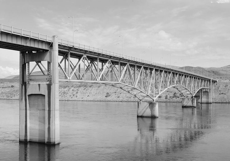
The Columbia River Bridge, also known as the Bridgeport Bridge, at Bridgeport, Washington was built to span the Columbia River in 1950. Composed of three spans, the bridge is a steel continuous riveted deck truss carrying Washington State Route 17 on a 26-foot (7.9 m) wide roadway and two 3-foot (0.91 m) sidewalks. The center portion of the bridge spans 300 feet (91 m), flanked by 250-foot (76 m) end spans. The 70-foot (21 m) north approach span and the 100-foot (30 m) south approach span are supported by steel plate girders. The bridge played a significant role in the construction of the Chief Joseph Dam just upstream, as no bridge crossing had previously existed in the area. Construction on the dam started in 1945 and was completed, apart from the powerplant, in 1955. The bridge was designed and built by the U.S. Army Corps of Engineers as part of the Chief Joseph dam project, and is significant for its association with the project and as a major crossing of the Columbia.
The bridge was placed on the National Register of Historic Places on May 31, 1995.