
Opening date 1979 Length 5,962 ft (1,817 m) Height 72 m Catchment area 195,285 km² | Width (crest) 22 ft (7 m) Opened 1979 Construction began 1949 | |
 | ||
Operator United States Army Corps of Engineers Similar Wells Dam, Grand Coulee Dam, Rock Island Dam, Priest Rapids Dam, Rocky Reach Dam | ||
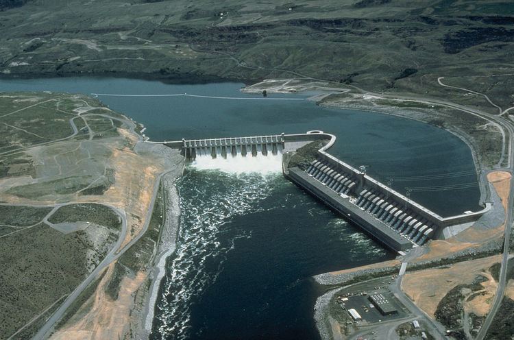
The Chief Joseph Dam is a concrete gravity dam on the Columbia River, 2.4 km (1.5 mi) upriver from Bridgeport, Washington. The dam is 877 km (545 mi) upriver from the mouth of the Columbia at Astoria, Oregon. It is operated by the USACE Chief Joseph Dam Project Office, and the electricity is marketed by the Bonneville Power Administration.
Contents
Map of Chief Joseph Dam, Bridgeport, WA 98813, USA
HistoryEdit
The dam was authorized as Foster Creek Dam and Powerhouse for power generation and irrigation by the River and Harbor Act of 1946. The River and Harbor Act of 1948 renamed the project Chief Joseph Dam in honor of the Nez Perce chief who spent his last years in exile on the Colville Indian Reservation. Because of its lack of fish ladders, Chief Joseph Dam completely blocks salmon migration to the upper Columbia River system.
Construction began in 1949, with the main dam and intake structure completed in 1955. Installation of the initial generating units was completed in 1958. Eleven additional turbines were installed between 1973 and 1979, and the dam and lake were raised 3 m (10 ft), boosting the capacity to 2,620 MW, making Chief Joseph Dam the second largest hydroelectric power producer in the United States.
TypeEdit
Chief Joseph Dam is a run-of-the-river dam which means the lake behind the dam is not able to store large amounts of water. Water flowing to Chief Joseph Dam from Grand Coulee Dam must be passed on to Wells Dam at approximately the same rate. With 27 main generators in the powerhouse, it has the hydraulic capacity of 6,030 m3/s (213,000 cu ft/s).
In the event more water flows to Chief Joseph Dam than could be used for power generation, the spillway gates would be opened to pass the excess water. With an average annual flow rate of 3,058 m3/s (107,992 cu ft/s), the Columbia River seldom exceeds the powerplant’s capability to pass water, and spilling of water is infrequent at Chief Joseph Dam.
ReservoirEdit
The reservoir behind the dam is named Rufus Woods Lake, and runs 82 km (51 mi) up the river channel. Bridgeport State Park, on the lake, is adjacent to the dam.