
Country United States FIPS code 36-17409 Elevation 456 m Local time Wednesday 7:18 PM | State New York Time zone Eastern (EST) (UTC-5) GNIS feature ID 0978854 Population 1,451 (2010) | |
 | ||
Weather 5°C, Wind SW at 26 km/h, 60% Humidity Area 660.2 km² (627 km² Land / 33.15 km² Water) | ||
Colton is a town in St. Lawrence County, New York, USA. The population was 1,451 at the 2010 census. The town, originally named Matildaville, is named after early settler Jesse Colton Higley.
Contents
- Map of Colton NY 13625 USA
- History
- Geography
- Demographics
- Notable People
- Communities and locations in Colton
- References
Map of Colton, NY 13625, USA
The Town of Colton is located in the southeast part of the county and is south of the Village of Potsdam.
History
The first land patents were issued in 1776. The first settlement occurred around 1825 near Colton village in the northern part of the town.
Colton was organized in 1843 from part of the Town of Parishville. Additional land from Parishville was added to Colton in 1851, and Colton was increased in 1876 from territory taken from the Town of Hopkinton.
The Zion Episcopal Church and Rectory was listed on the National Register of Historic Places in 2003. The Hepburn Library of Colton was added in 2012.
Geography
According to the United States Census Bureau, the town has a total area of 254.9 square miles (660 km2), of which, 242.1 square miles (627 km2) of it is land and 12.8 square miles (33 km2) of it (5.04%) is water.
Colton is the largest town in St. Lawrence County. St Lawrence county is the largest county in NY state. The south town line is the border of Hamilton County and Herkimer County.
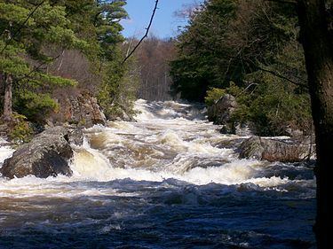
The Raquette River flows through the west part of the town. The town is in the foothills of the Adirondack Mountains. Most of the town, the southern part, is inside the Adirondack Park.
New York State Route 56 intersects New York State Route 68 at Colton village. New York State Route 3 intersects NY-56 in the east-central part of the town at Sevey Corners.
Demographics
As of the census of 2000, there were 1,453 people, 604 households, and 405 families residing in the town. The population density was 6.0 people per square mile (2.3/km²). There were 1,163 housing units at an average density of 4.8 per square mile (1.9/km²). The racial makeup of the town was 99.17% White, 0.34% Native American, 0.07% Asian, and 0.41% from two or more races. Hispanic or Latino of any race were 0.89% of the population.
There were 604 households out of which 25.2% had children under the age of 18 living with them, 55.6% were married couples living together, 6.1% had a female householder with no husband present, and 32.8% were non-families. 26.0% of all households were made up of individuals and 10.3% had someone living alone who was 65 years of age or older. The average household size was 2.40 and the average family size was 2.90.
In the town, the population was spread out with 22.6% under the age of 18, 6.3% from 18 to 24, 24.8% from 25 to 44, 30.0% from 45 to 64, and 16.2% who were 65 years of age or older. The median age was 42 years. For every 100 females there were 102.4 males. For every 100 females age 18 and over, there were 101.8 males.
The median income for a household in the town was $38,875, and the median income for a family was $44,637. Males had a median income of $35,000 versus $22,443 for females. The per capita income for the town was $20,528. About 10.5% of families and 14.7% of the population were below the poverty line, including 22.5% of those under age 18 and 6.5% of those age 65 or over.