
Length 53.55 km | ||
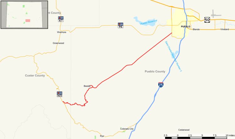 | ||
State Highway 78 is a highway connecting Pueblo to the town of Beulah and the San Isabel National Forest.
Contents
Map of CO-78, Pueblo, CO 81005, USA
Route description
SH 78 runs 33.2 miles (53.4 km), starting at a junction with State Highway 165 in San Isabel National Forest and ending at a junction with State Highway 45 in Pueblo. A short spur route, also marked as SH 78 runs 1.5 miles (2.4 km) from the main highway, ending at the intersection of Grand and Pennsylvania avenues in Beulah.
References
Colorado State Highway 78 Wikipedia(Text) CC BY-SA