
Length 9.107 km | ||
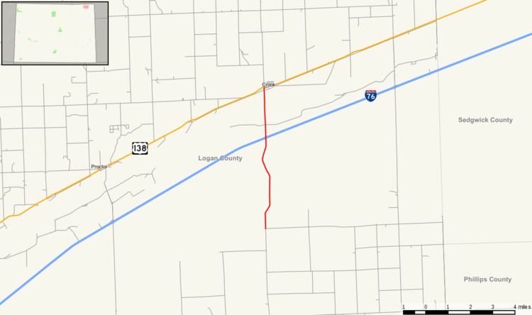 | ||
State Highway 55 (SH 55) is a state highway that connects Crook, Colorado to I-76.
Contents
Map of State Hwy 55, Colorado, USA
Route description
SH 55 runs 5.7 miles (9.2 km), starting at a junction with U.S. Highway 138 in Crook, then south across the South Platte River to I-76. The highway ends at CR 15 northeast of Fleming.
Major intersections
The entire route is in Logan County.
References
Colorado State Highway 55 Wikipedia(Text) CC BY-SA