
Length 2.676 km | Counties: Adams | |
 | ||
North end: SH 224 east of Westminster | ||
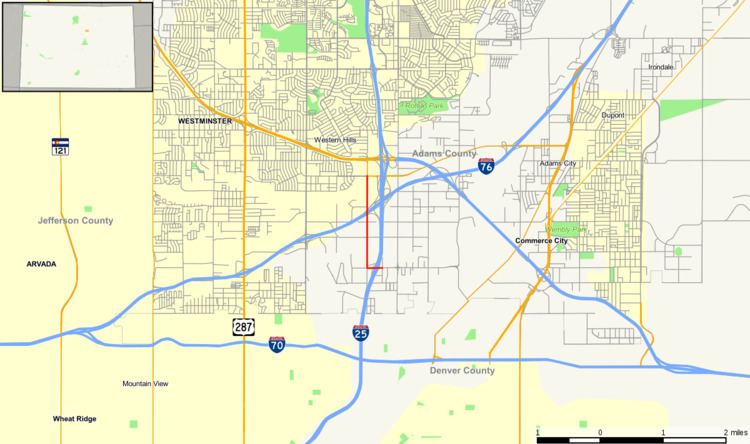
State Highway 53 (SH 53) is a state highway in Adams County, Colorado, United States, north of Denver. It connects Interstate 25 with State Highway 224 along Broadway Street.
Contents
Map of CO-53, Denver, CO, USA
Route description
SH 53 begins at the 58th Avenue interchange (exit 215) on I-25. After a short distance west on 58th Avenue, the route turns north on Broadway Street, crossing under Interstate 76 with no access and ending at 70th Avenue (SH 224).
History
In 1971-1972, Colorado constructed an extension of Broadway Street from 66th Avenue north to SH 224, including a bridge over Clear Creek. Along with existing portions of Broadway Street and 58th Avenue, the new roadway was designated State Highway 53.
Major intersections
The entire route is in Adams County.
References
Colorado State Highway 53 Wikipedia(Text) CC BY-SA