
Length 12.18 km | ||
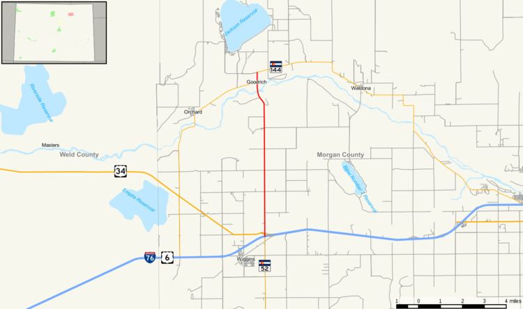 | ||
State Highway 39 is a highway in northeast Colorado.
Contents
Map of CO-39, Colorado, USA
Route description
SH 39 runs 7.6 miles (12.2 km), starting at a junction with I-76 near Wiggins, going north across the South Platte River and ending at a junction with SH 144 near Jackson Lake State Park.
Major intersections
The entire route is in Morgan County.
References
Colorado State Highway 39 Wikipedia(Text) CC BY-SA