
Length 21.6 km | ||
 | ||
East end: I-70 Bus. / US 50 in Grand Junction | ||
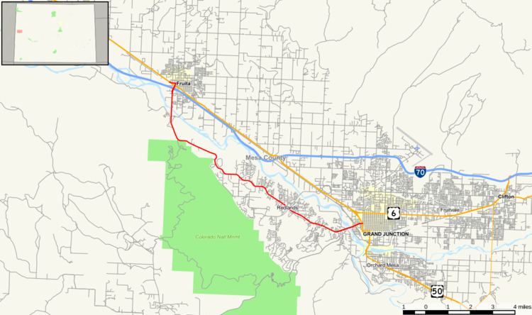
State Highway 340 is a 13.4 mi (21.6 km) long state highway in the U.S. state of Colorado. The highway's eastern end is at the junction of US 50 and I-70 Business in Grand Junction and its western end is at U.S. Highway 6 in Fruita. This highway is mainly used by the residents of Grand Junction's suburb Redlands.
Contents
Map of CO-340, Grand Junction, CO, USA
Route description
The route begins at a concurrency of U.S. Highway 6 and U.S. Highway 50 in Fruita. The route then turns onto cherry Street in Fruita where it junctions with Interstate 70. The Highway then moves then heads south, passing over the Colorado River, where it heads into The Redlands. There, it traverses the suburban area as Broadway Rd, passing the Colorado National Monument on the south side of the highway. As Highway 340 travels eastward, it enters Downtown Grand Junction, meeting again with the Colorado River and passing over the Riverside Parkway.Then, the highway ends at Interstate 70 Business Loop and U.S. Highway 50.
History
The route was defined in 1939, when it moved along its current alignment but continued to U.S. Highway 6 in Palisade. This entire length was paved by 1955. The east terminus was then moved to SH 146, today's SH 141, in 1970. Two years later, the east terminus was moved all the way to where it is now in Grand Junction.
Major intersections
The entire route is in Mesa County.