
Length 32.72 km | ||
 | ||
Counties Denver, Arapahoe County, Colorado | ||
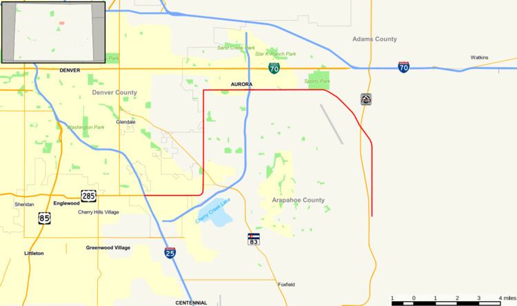
State Highway 30, alternatively known as Hampden Avenue, is a state route in the independent city of Denver and Arapahoe County. Its west end is at Interstate 25 and US 285 in Denver and its east end is at Quincy Avenue east of Aurora.
Contents
Map of State Hwy 30, Denver, CO 80237, USA
Route description
The route begins at Interstate 25 and U.S. Highway 285 in Denver. It then winds eastward and exits Denver and enters Arapahoe at about 2.0 miles, then reenters Denver at about 2.3 miles. At 2.6 miles, the route changes direction to north and crosses SH 83 at 3.8 miles, where it again leaves Denver and enters Arapahoe County and Aurora. It continues northward, crosses the Highline Canal, and at 7.8 miles it then turns east again. At about 10 miles, it traverses across Interstate 225. It then continues eastward, and forms the northern and eastern border for Buckley Air Force Base. It further leaves the Aurora city limit at about 18.3 miles, and finally ends at Quincy Avenue east of Aurora.
History
The route was established in 1955, when it began at SH 70 (deleted) southeastward to today's terminus. The southern terminus was moved to Smoky Hill Road by 1960 and to Quincy Avenue by 1966, when the road entirely paved. The section along Havana Street was added in 1970, when that part of US 285 was cut.