
Length 33.09 km | Counties: El Paso | |
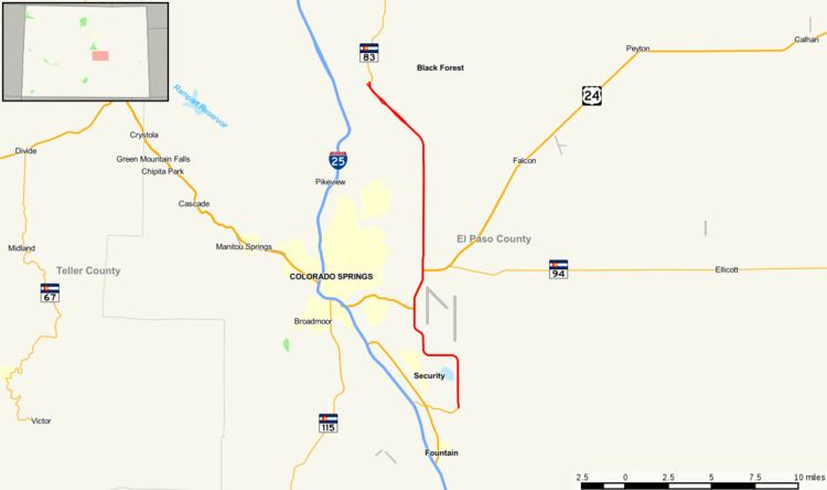 | ||
North end: SH 83 near Black Forest | ||
State Highway 21 is an expressway in El Paso County, in eastern Colorado Springs. The highway serves as an eastern bypass for the city of Colorado Springs. Officially, the routing is from SH-16(Mesa Ridge Parkway) in the south to Interquest Parkway/SH 83 in the north.
Contents
Map of CO-21, Colorado Springs, CO, USA
Route description
For most of its routing the highway is a four to six-lane, limited access highway. In the north, it begins as a semi-freeway with a 60 mph speed limit, and becomes a six lane expressway with a 55 mph speed limit in the city of Colorado Springs after Union Boulevard and remains so throughout the entire route. The northern section, from Research Parkway to Interquest Parkway/SH 83 is constructed to interstate highway standards with sufficient right-of-way to construct planned overpasses and on/off-ramps. CDOT completed interchanges and bridges at Union Boulevard and Briargate Parkway in 2013 and an interchange at Old Ranch Road in 2015. Future interchanges at Research Parkway, SH 83 and a future freeway to freeway interchange planned for the SH 21/I-25/Northgate Blvd interchange will be constructed based on the availability of funding and need. The whole routing from I-25 to Proby Parkway is planned as a controlled-access freeway. The southern portion (from Research Parkway) is a limited-access highway with interchanges constructed at Woodmen Road and Platte Ave/US 24. It ends at Mesa Ridge Parkway in Security-Widefield.
History
The route was established on October 1, 2007. When defined, its routing included the entire length of Powers Boulevard.
Junction list
The entire route is in El Paso County.