
Length 257 km | ||
 | ||
North end: I-70 Bus. at Grand Junction | ||
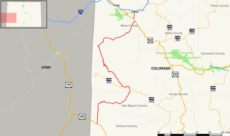
State Highway 141 is a 159.7 mi (257.0 km) long state highway in far western Colorado. Though nominally oriented north–south, SH 141 winds around a considerable amount due to the rugged terrain and ultimately forms a giant S shape.
Contents
Map of CO-141, Colorado, USA
Route description
Beginning west of Dove Creek, the highway runs north, then swings east to drop into a canyon and cross the Dolores River at Slick Rock. SH 141 follows the Dolores for a short while, then continues east through Gypsum Gap, then north through Broad Canyon. At a junction with SH 145 the highway turns west through Naturita, then northwest following the San Miguel River to the Dolores River. It continues a winding path northwest along the Dolores to Gateway. There it turns northeast, running through the Unaweep Canyon to the Gunnison River valley where it joins US 50 at Whitewater. The highway heads northwest alongside the Gunnison River, splitting off from US 50 as it nears Grand Junction. It heads north across the Colorado River and ends at a junction with I-70 Bus. east of Grand Junction.
SH 141 between Naturita and Whitewater is part of the Colorado designated Unaweep Tabeguache Scenic Byway.