
Length 75.62 km | ||
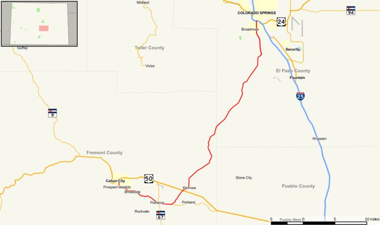 | ||
State Highway 115 is a state highway that runs from US 50 interchange in northern Cañon City to Interstate 25/ Nevada Avenue in Colorado Springs.
Contents
Map of CO-115, Colorado, USA
Route description
Major construction has been done on the mountainous portion of the highway due a high amount of accidents because of lane narrowing. Highway 115 gives service through several small towns along the eastern mountains such as Florence and Penrose. It is the only highway that gives in/out service to Colorado Springs from Cañon City.
History
The route was established in the 1920s, when it connected U.S. Highway 50 near Florence to Colorado Springs. By 1950, the west terminus was fixed to State Highway 120 . The US 50 interchange was built by 1977, when the entire route was paved. A small change in the routing near its east end occurred in 2007.