
Length 53.25 km | ||
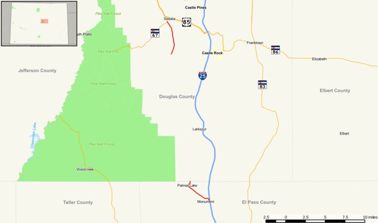 | ||
State Highway 105 is a state highway that runs from SH 83 in Black Forest to SH 67 (Manhart Avenue) in Sedalia. The highway serves the communities of Monument and Palmer Lake and the unincorporated areas of Douglas and El Paso counties.
Contents
Map of CO-105, Colorado, USA
Route description
The road begins at State Highway 83 and maneuvers west where it reaches Interstate 25 with a complex interchange and begins heading westward through the city of Monument. The road then abruptly turns northward and northwestward, nearing Palmer Lake. Once past the lake, the road begins northward along Spruce Mountain Road, turning abruptly westward onto Perry Park Road, abruptly ending at the El Paso - Douglas county line, where it becomes Douglas County Road 105. The road moves through the foothills of Douglas County as Perry Park Road and resumes as State Highway 105 at Wolfsenberger Road. It then heads westward to its terminus at SH 67 near Sedalia.
History
The route was established in the 1920s, when it connected U.S. Highway 87, now Interstate 25, to Sedalia. By 1963, the road was deleted from Palmer Lake to Interstate 25 and the road was paved to its entirety. The road was extended to replace SH 50 (now deleted) due to confusion with U.S. Highway 50. A section from SH 83 to I-25 was deleted in October 2007.