
East end: CR 151 at Squaw Pass Length 36.19 km | ||
 | ||
County | ||
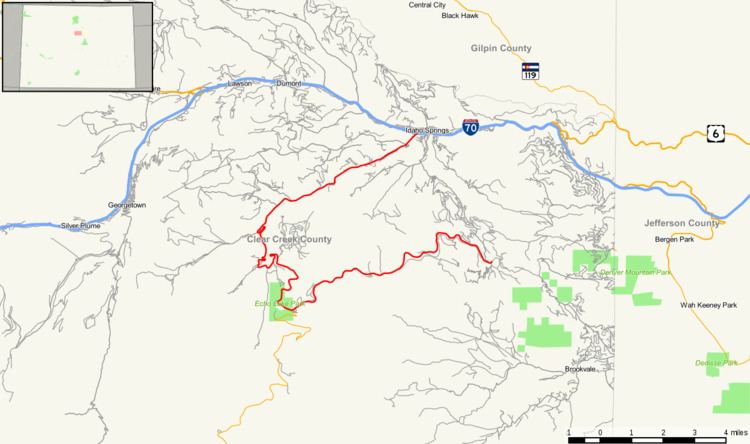
State Highway 103 (SH 103) in the U.S. state of Colorado runs from I-70 at Idaho Springs to county roads 151 and 103 at Squaw Pass. The thirteen miles (19 km) from Idaho Springs to State Highway 5 forms about half of the Mount Evans Scenic Byway.
Contents
Map of CO-103, Idaho Springs, CO 80452, USA
Route description
The route begins at Idaho Springs, where it heads southwest away from the center of the city and follows the Chicago Creek. After exiting the city, the route begins climbing in elevation, ultimately reaching an elevation of about 10,000 feet, where it meets State Highway 5, at Echo Lake Park. Together with Highway 5, the route to this point forms the Mount Evans Scenic Byway, the highest paved road in North America. Then the route continues through Squaw Pass, along the upper end of Echo Mountain Ski Area and on to its terminus at County Route 151. Past this point, the highway is not marked by CDOT, but the rest of what is called Squaw Pass Road descends toward Evergreen.
History
The route was established in 1923, where it began at U.S. Highway 285 and traversed to Idaho Springs. The segment east of Squaw Pass was renumbered in 1954, and the route was entirely paved by 1956.
Major intersections
The entire route is in Clear Creek County.