
Population 194 (2011) Civil parish Coln St. Dennis Local time Thursday 4:46 AM | OS grid reference SP0810 Sovereign state United Kingdom | |
 | ||
Weather 10°C, Wind SW at 24 km/h, 96% Humidity | ||
Coln St. Dennis is a village and civil parish on the River Coln in Gloucestershire about 3 miles (4.8 km) southwest of Northleach and about 7 miles (11 km) northeast of Cirencester. The parish includes the village of Coln Rogers and the hamlets of Calcot, Fossebridge and Winson. The Fosse Way Roman road, which is now the A429 trunk road, forms the western boundary of the parish.
Contents
Map of Coln St. Dennis, UK
History
About 1.3 miles (2.1 km) southwest of Coln Rogers are Colnpen Long Barrow and a group of four round tumuli. All are prehistoric burial mounds.
The Church of England parish church of Saint James the Great is Norman, with the addition of some Decorated Gothic and Perpendicular Gothic windows and oher details. The church was dedicated to Saint Katherine in the 13th century, Saint Dennis in the 18th century, and is believed to have once been dedicated to Saint Kenelm.
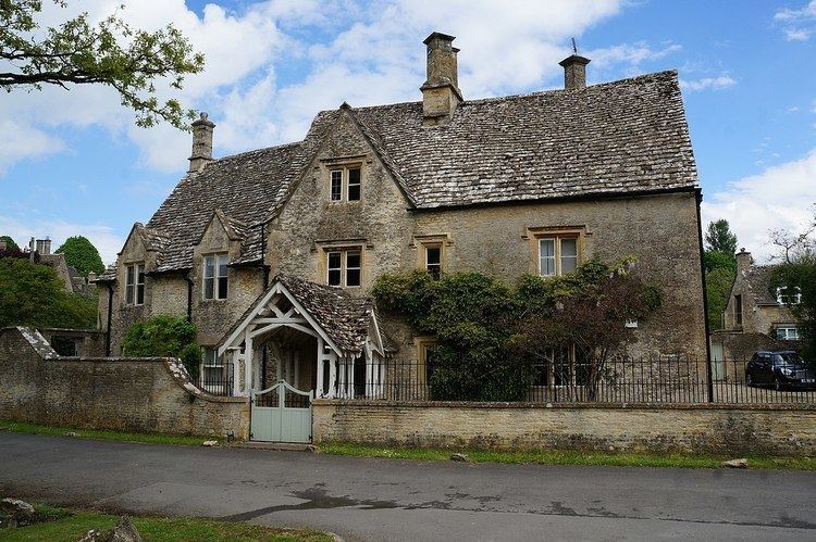
Coln St. Dennis Manor House was built in the 17th century and altered in 1965. Pindrup is a farmhouse dating from the 17th and 18th centuries. St. James' Rectory was designed by Richard Pace and built in 1810.