
Length 29 km Mouth Yèvre | River mouth Yèvre | |
 | ||
Progression | ||
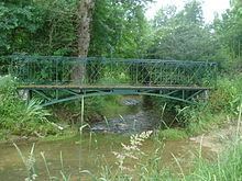
The Colin is a 29.1-kilometre (18.1 mi) long river in the French department of Cher. It is an affluent of the Yèvre and a sub-affluent of la Loire.
Contents
Map of Le Colin, France
Geography
The river's source is at Humbligny, where it drains La Motte d'Humbligny, the highest point in the Sancerrois region. It runs through Les Aix-d'Angillon and Sainte-Solange and joins the Yèvre at Saint-Germain-du-Puy.
Communes
Humbligny, Morogues, Aubinges, Les Aix-d'Angillon, Sainte-Solange, Saint-Germain-du-Puy,
References
Colin (river) Wikipedia(Text) CC BY-SA